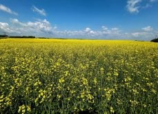
Steven Quiring wants to be able to offer his Uncle Lloyd, a farmer in Shaunavon, Sask., more than just an informed guess about when the next drought will come.
The University of Manitoba weather researcher thinks a study he’s doing may help unlock some of that mystery.
“Hopefully, at one point, this will be a tool that (farmers) will be able to have,” Quiring said.
He recently told the annual Congress of the Canadian Meteorological and Oceanographic Society that he thinks there are strong connections between distant but powerful weather triggers and the severe droughts that hit the Prairies every few years.
Read Also
Pakistan reopens its doors to Canadian canola
Pakistan reopens its doors to Canadian canola after a three-year hiatus.
These distant weather triggers are called “teleconnections.” They include the well-known El Nino and La Nina phenomena that occur in the south Pacific and the arctic oscillation that happens in the north.
El Nino refers to warmer than normal water near the coast of South America. La Nina happens when the ocean water in the south Pacific is colder than normal.
Quiring said he believes the south Pacific phenomena explain four of the past five extreme drought years. A prairie drought doesn’t tend to happen during the highest point of either El Nino or La Nina, but in the middle between the two swings.
The one severe drought that didn’t follow this pattern was in 1988, which happened at the height of La Nina, which was particularly severe.
Quiring said the correlation between prairie droughts and the south Pacific events is the strongest teleconnection he’s been able to find. That’s fortunate, because farmers would benefit if accurate weather prediction models can be developed based on El Nino and La Nina.
These events occur between December and March. If they provide a strong hint of a coming drought, farmers will know before they seed a crop. If the helpful phenomena occurred at the same time as the growing season, they wouldn’t offer much help at all, Quiring said.
A high pressure ridge that settles over the Rockies and the Prairies is what usually causes drought. The jet stream is pushed north, which takes the “storm belt” of rain clouds north of the grain-growing areas and keeps wet southern air out.
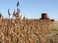
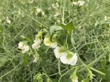
This spring’s drought in Saskatchewan and Alberta is not the kind that Quiring is studying. All the Prairies are dry during a severe drought caused by teleconnections. But that’s definitely not the case this year, with eastern Manitoba farmers struggling to seed their crops in saturated soils. These kinds of regional or zonal droughts are harder to predict, he added.
Quiring said more work is needed, because no one has figured out how to correctly predict future weather patterns based on teleconnections.
He said his model can explain 83 percent of the drought conditions that have occurred on the Prairies in the past few decades, but that doesn’t mean he could predict 83 percent of future droughts.
If meteorologists can figure out how to do that, a farmer making his seeding plans in March would have a better idea if he was likely to face a drought.
Quiring, who is a graduate student with the Centre for Earth Observation Science, said he wants his work to help farmers.
“I want this to have some sort of applied value.”
Long range weather forecasting is difficult, but all climatologists want to do it. They all know their present ability is limited and keep looking for keys that will unlock the future.
“You get excited by your work and you hope you’ve found the goose that lays the golden eggs,” Quiring said.
“But it is a very humble (discipline), because you just can’t predict as well as people would like.”