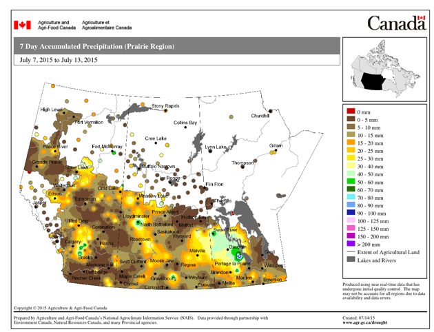
Rain in the past week has improved soil moisture conditions in parts of Saskatchewan and Alberta although some areas are still suffering and many regions will need more moisture to carry the crop to harvest.
Dry weather has already damaged yield prospects in many areas of the western Prairies, while Manitoba crop conditions are generally good.
The first map below from Agriculture Canada shows rain accumulation over the past seven days to Monday.
—————
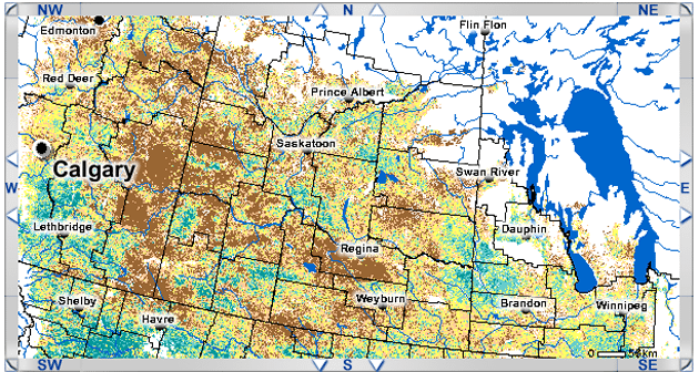
The map below shows the Normalized Difference Vegetation Index for July 6-12 compared to normal. Yellow denotes conditions similar to normal. Turquoise shows areas better than normal and brown denotes worse than normal.
——————
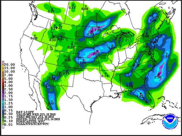
This final map from the weather service of the U.S. National Oceanic and Atmospheric Administration shows the rain accumulation forecast for July 15-18. Although Environment Canada identifies a risk of thundershowers over the period, with the possibility of precipitation rising to 60 percent Thursday in a large part of Saskatchewan, this map shows little chance of widespread, significant rain, except in south eastern Manitoba.
Drier weather in the eastern U.S. cornbelt will help fields dry out after recent excess rainfall.