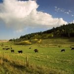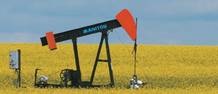
The same technology that manages overlap and application rates in agriculture has found a home in the oil and gas sector.
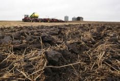
The industry has long dealt with its non-toxic drilling waste by spreading it on farmland, but that often resulted in material pooling near field headlands or at the edges of pastures.
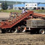
As well, application was often difficult because the process included placing pylons in fields and providing maps to vacuum truck operators. These guidance tools became challenging to manage after dark, and there were often application errors.
Read Also

Saskatchewan puts crown land auction on hold
Auctions of Saskatchewan crown lease land are once again on hold.
Sometimes these problems resulted in fines and other times landowners were disappointed in the outcomes and refused to allow the practice to continue.
Regulators have recognized in recent years that the industry is using GIS mapping strategies to provide greater guarantees that the drilling waste stays where it was applied.
As a result, companies have been given more liberal application boundaries and allowed to self-report.
However, application technologies haven’t kept up with the mapping.
Summit Liability Solutions of Calgary is changing that.
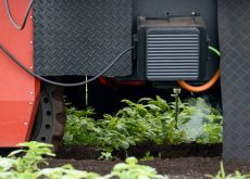
The company, which provides land-spray application and regulatory compliance services, has developed the oil and gas industry’s first precision land-spray system based on tools farmers have been using for years.
Marissa Rechmann, Summit’s head of business development, recently told the Saskatchewan Institute of Agrologists that the company wanted to offer its clients a better service.
“Today we are achieving compliance. There are going to be no non-compliance events, letters, names in the paper or fines. There is a long-term cost savings, and it enhances relationships for our clients with landowners, enforcement (bodies) and the public in general,” she said.
“We looked at agrologists for leadership here. We had professional agrologists on staff and we partnered with (Calgary based) Hemisphere and we used their Outback systems to create equipment that allowed us to create an application map and utilize a rate controller and an (overlap prevention) system.”
The result was the S3S Summit Earth navigator.
“It is like having an environmental specialist onboard the vac truck 24 hours a day,” Rechmann said.
Al Scholz of the SIA said the crossover between farming technology and other industries is becoming more common.
“People often think agriculture might be inheriting technology from others, but it’s the other way around. Agriculture leads in many areas,” he said.
“About 25 percent of agrologists in Saskatchewan are doing some work in this area, and it is growing.”
Sixty percent of professional agrologists in Alberta are performing environmental services.
Summit now works on water compliance systems for the oil and gas business, fleet management and adding telematics, which provides remote installation of application maps and recovery of as-applied maps.
Water licences are allocated based on the location of a well or surface body, rates of draw and total removal. With many water trucks serving an area, it can be difficult to manage that resource, Rechmann said.
“We are going to offer a compliance solution for this as well, and that too is a first, based on precision agriculture tools that farmers have been using for years, in some cases,” she said.