European company works to provide farmers in war-torn country with better information as Russian invasion continues
OneSoil, the European satellite imaging company willing to provide free services to every farm on Earth, is actively working with Ukrainian producers to provide them eye-in-the-sky visual precision agricultural images.
Launched in Minsk, Belarus, in 2015, OneSoil is dedicated to bringing free satellite information to any farmer anywhere who wants it. It uses public data from the European Space Agency to build advanced image processing technologies. Once the images are processed, they’re available to anyone in a matter of seconds in a format that precision ag farmers can use.
Read Also
Why feds imposed EV tariffs
Moe and Kinew have a fight on their hands when it comes to eliminating the EV tariff. Canada has to worry about pissing off the U.S. and Mexico and hundreds of thousands of auto workers.
OneSoil moved to Poland in 2021 due to the global expansion, both in terms of markets covered and the team’s growth. That was before the war started.
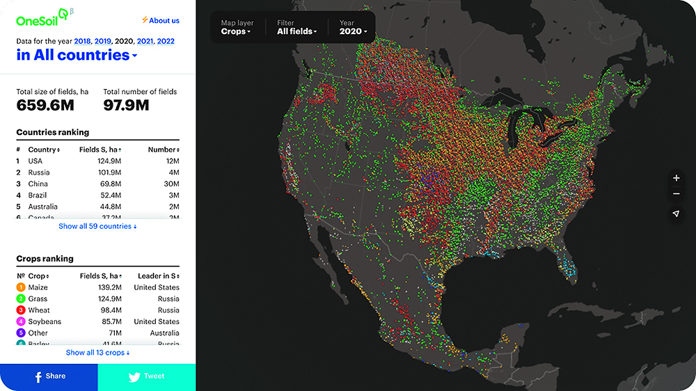
As evidence of that ongoing commitment the company has just launched a new platform called OneSoil Map. This is a data visualization and mapping solution that melds proprietary artificial intelligence with satellite imagery, giving farmers live data and rich insights to understand the state of crops in their fields.
These tools do what precision agriculture does everywhere — allow farmers to remotely monitor the state of crops, quickly detect issues, work with productivity zones, apply variable-rate fertilizers and seeds and boost sustainable farming practices.
“We’ve done a fair bit of precision work with Ukrainian farmers in the past seven years, so we’ve accumulated a lot of data,” said Morten Schmidt, OneSoil’s chief executive officer.
“We’ve been evaluating the impact of the invasion by comparing this year’s crop size to last year’s pre-crisis crop size.
“The ground truth data to develop our systems originally came from the large agro-holdings in Ukraine. Farmers tell us they need our precision agriculture services now even more than before. Their resources are so scarce. Not enough seed and fertilizer or diesel, especially diesel. So they are struggling to stretch these limited resources. Precision agriculture helps them do that.…
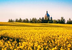
“Winter crops of course were all planted before the start of the war, but spring crops were planted after the invasion. We compare data from last year to this year and study areas touched by the war. Our contacts within Ukraine tell us farmers have replaced industrial crops like corn and sunflower with crops that provide food and security in their own home market in the coming year, like buckwheat.”
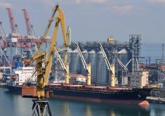
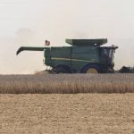
Schmidt said it looks like planted acres have only dropped by 10 percent on average, although some areas have experienced a 50 percent drop due to the invasion. At this point in time, the danger to farmers is how to harvest the available crop and load it on a ship.
“It’s misleading to look at how many acres are ready to harvest,” Schmidt said.
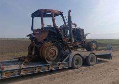
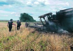
“Many of these fields look good from satellite but won’t be harvested because of mines and unexploded artillery. Unfortunately, our images don’t give us that information. Our current generation of technology wasn’t designed for warfare.
OneSoil does not own the images. They use open-source public data from the European Space Agency, with high-quality 10-metre resolution.
Schmidt said OneSoil had been using its in-house agronomists to create its own algorithms. However, in order to reach more farmers with its free imaging service, OneSoil expects to partner with leading agronomic companies to better use the data.
He said ground truthing was a big project. The company relied on soil and yield data generated over the years by major agricultural holdings in Ukraine, Russia and other farming regions around the world.
Global data acquisition for precision agriculture includes Canada.