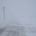
A low pressure system moving up from the Dakota’s into the eastern Prairies this morning. The heaviest rains are currently falling in western and central Manitoba. There is also a low pressure system in northern Saskatchewan which is bringing light showers/fog to northern Alberta. This week is expected to see a number of systems track through the eastern Prairies over the next five days. The western areas of the Prairies are expected to be cool and mostly dry through the week. There maybe some overnight snow in northern growing regions, but temperatures should be warm enough to keep it from remaining for the winter season.
Read Also
AM Market Report – October 27, 2025
GOOD MORNING…HERE IS YOUR MORNING MARKET NEWS OVERNIGHT GRAIN TRADE ICE canola futures are trading mostly $4 to $6/tonne higher…

There will be a large temperature gradient across Western Canada today with highs ranging from the mid single digits in northern Alberta to the mid teens in eastern Manitoba. Temperatures will improve in the western regions to the upper single digits to the low teens. The eastern Prairies will cool during the week with highs mostly in the mid to upper single digits from Tuesday through Friday. Temperatures normally are mostly in the the 5C to 7C range at the end of the October.

The long-term forecasts are finally changing with a trough expected to build in the western Prairies by Remembrance Day. The trough in Alberta and western Saskatchewan is likely to bring winter to northern Alberta and northwestern Saskatchewan. A ridge is still expected in the eastern Prairies with temperatures expected to remain above normal through the middle of November.


To continue reading, please subscribe to Western Producer
Subscribe nowAlready a subscriber? Log In


