NASHVILLE, Tenn. – A major U.S. weather forecasting firm predicts La Nina did most of her damage last year and will peter out before seeding.
“The La Nina temperature pattern in the Pacific we think is starting to moderate and we’re looking for that ocean temperature to trend more towards neutral by the end of the springtime,” said DTN senior agricultural meteorologist Bryce Anderson.
“Then you would have more of a normal weather pattern across the corn belt going into the summer.”
A La Nina weather event that extends into summer is normally associated with a drier and warmer trend across key growing regions of the U.S. and can lead to dramatic declines in grain and oilseed production.
Read Also

Why feds imposed EV tariffs
Moe and Kinew have a fight on their hands when it comes to eliminating the EV tariff. Canada has to worry about pissing off the U.S. and Mexico and hundreds of thousands of auto workers.
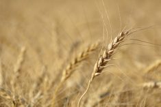
For instance, during the 1988 La Nina, corn yields were knocked back 30 percent from the previous year and tumbled 43 percent in Iowa and Illinois, two key production regions.
Even if there was a repeat of 1988’s dry summer, conservation tillage techniques, stable hybrids and new rootworm protection traits would likely limit the damage to the U.S. corn crop to 10 to 15 percent, said Anderson.
But he doesn’t believe that is going to materialize. In fact, U.S. growers might be facing the opposite problem due to La Nina’s tendency to bring wetter and colder than normal winters to the corn belt.
In January, it was dry in the eastern corn belt. By late February, there was surplus moisture with 1.5 to 1.8 metres of accumulated snow cover throughout much of Illinois and Iowa.
“This (moisture) is starting to get on the edge of being too much of a good thing,” said Anderson.
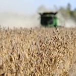
Farmers may be forced to delay spring fieldwork in some areas, which would restrict their corn and soybean yields. There is even the prospect for a flood of the Mississippi River on a scale not seen since 1965.
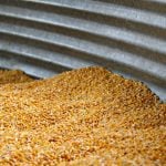
If growers are able to get onto their fields they should have a decent shot at matching last year’s corn yields and exceeding last year’s La Nina-reduced soybean yields.
Anderson is also looking for a slow improvement in the dry conditions in the spring wheat growing regions of the northern Plains, states like North and South Dakota, Montana and western Minnesota.
Several weather reporting stations in South Dakota have reported dry conditions in their top 10 of all time, with a few reporting the driest winter on record. Anderson is predicting a gradual turnaround in conditions as spring and summer progresses.
But he is not optimistic about the weather outlook for the hard red winter wheat growing region of Kansas, Oklahoma and Texas, states that have been perpetually dry. Storms are moving rapidly through the region, failing to generate much precipitation.
“The Southwest Plains is a part of the States that is going to be the most challenged. It will have the toughest moisture situation,” said the meteorologist.
Looking at conditions around the world, he said La Nina caused some early season damage to Argentina’s corn and soybean crops but there has been a “remarkable recovery” in moisture conditions in that country, mitigating the chances of a crop disaster. Damage to Brazil’s soybean crop has been far less than anticipated.
Brazilian forecasts now estimate the soybean crop at 61.5 to 62.5 million tonnes, up one million from February forecasts.
La Nina has helped eastern Australia rebound from two successive droughts.
China has suffered some damage this winter but the storms have also improved soil moisture conditions in parts of that country.
Ukraine has the best soil moisture conditions Anderson has seen in three years. Europe is also looking at a full soil moisture profile heading into spring.
The southern Prairies in Canada has the same dry weather concerns as the U.S. Northern Plains, but the rest of the prairie grain belt appears in good shape.