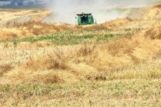
BANFF, Alta. – A photo can say more than a thousand words when assessing crop development, but the information must be timely.
Satellite photographs have provided grain growers with critical information about how their land produces and their crops develop.
Unfortunately, these images are delayed by weeks or months, may suffer from cloud shadow interference or go missing altogether because of weather. Photo resolution of about 30 metres is commonly lower than the one metre resolution that is preferred when creating maps for variable rate fertilizer or pesticide control.
Read Also

Manitoba searches for Plan B on canola oil exports
A new report explores Manitoba’s current canola oil trade and possible alternative markets to the U.S.
To solve these problems, Agri Trend Agrology of Red Deer and John Deere are introducing aerial photographic technology to Western Canada. The technology, which delivers one metre resolution, was initially proven in American cotton and higher-value row crops.
Rob Saik of Agri Trend, who recently attended the Canadian Consulting Agrologists Association’s North American Consulting School in Banff, said Deere’s Optigro system uses light planes that fly below the clouds, calibrated global positioning systems and a three or four day image and agronomic analysis.
“This is an opportunity to get real time information into a grain producer’s hands,” he said in an interview during the conference.
“Insect problems, fertility issues – within a few days of flying the fields we can have that information ready to confirm on the ground.”
Optigro uses aerial infrared and normalized difference vegetation index images to show plant stress and development. An agronomist can identify and confirm problem areas or those that might require additional nutrition during a field visit.
Jim Grief of Monticello, Iowa, tried the system last year in its early days of testing on cereal crops.
“I could really see the areas that were over and underfertilized,” he said.
“With (urea) nitrogen reaching $405 US per ton right now, I’m thinking Deere may have a lot of farmers looking at the Optigro concept as a way to give them near real time information about where to put their nitrogen dollars … when it comes to variable rate application in crop.”
Grief has previously used satellite mapping information from images taken in August.
“But we don’t get them until eight or nine months later and by then it’s just a reference tool for the soil condition in general,” he said.
“This is real time, in the season when we can still do something about a problem or to manage nutrients.”
Saik said producers could use the information to adjust fertilizer applications in June and early July before crops have fully committed to yield and quality.
U.S. Department of Agriculture soil scientist Jim Schepers said technology that allow producers to fine tune their fertilizer and pesticide applications during the cropping season are critical to environmental sustainability and agricultural profitability.
“This is the type of tool farmers can use to prevent wasted applications over a whole field when only a small area may benefit.”
Grief said the system would deliver its greatest benefits on larger fields, typical of the Canadian Prairies, where it might be difficult to identify crop issues until it was too late to deal with them.
Saik said his company’s strategy would involve an agrologist getting into the field to identify problems as they are highlighted in the aerial images.
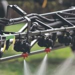
“The maps give us an identifiable area to put into a (smart) card that will be used in the sprayer or applicator,” he said.
Agri Trend will offer the service to prairie producers this season, co-ordinating flights from Lethbridge, Yorkton, Sask., and Brandon.
Grief said this may be a good year to introduce the service because of higher grain and input prices.
Saik said the service will cost about $4 per acre.