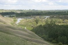
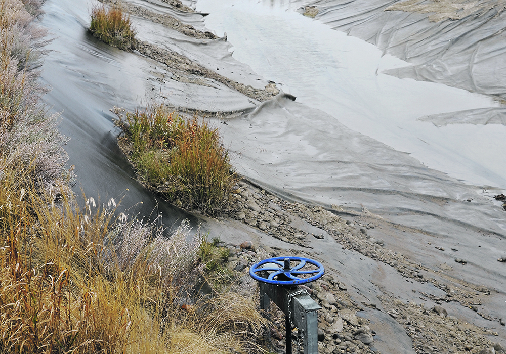
Low water levels in Lake Diefenbaker at times in the last couple of years have drawn concern from lake users.
Some posted photographs on social media of exposed boat launches and rocky beaches. The water was sometimes too low for the Riverhurst Ferry to operate.
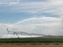
But this doesn’t mean the $4-billion project to expand irrigation from the lake to about 500,000 acres in 10 years is at risk from not enough water.
Curtis Hallborg, manager of flow forecasting and operations planning at the Water Security Agency, said lake levels are determined by the operating targets for certain times of the year.
Read Also
Feds propose overhaul of chronic wasting disease control program
Chronic Wasting disease control program getting updated by Canadian Food Inspection Agency with feedback encouraged from producers.
He told the Saskatchewan Irrigation conference that water availability depends on the alpine snowpack in Alberta and rainfall. WSA has no control over those.
“What we do have control over at the reservoir is the outflows,” he said.
In the winter, water is drawn down and released through the hydro-power turbines for a mid-March target of between 550.5 and 552 metres, he explained.
The minimum level for May 1 irrigation is 551.5 metres, although not every project can irrigate at that level.
By mid-May the target for recreational use on the lake is 552 metres. Again, this doesn’t accommodate all uses, Hallborg said.
However, from May 12 to July 1, the lake operates under guidelines for the endangered piping plover. The shorebirds love the rocky beaches for nesting and the habitat is protected to allow for that.
Hallborg said any increases during this period are limited to three metres, and below 555 metres, by pushing water through the power plant.
Through the summer the lake is ideally one-half to one metre below full supply.
“If we’re sitting right full there’s a lot of erosion happens around the reservoir,” he said. “There’s no beach area and we don’t have a buffer for a rainfall event.”
The winter draw-down provides flood storage for a May-June rainfall event and maximizes hydro production during winter when that power is of higher value, he said.
In 2021, the summer levels were “way short” of where WSA wanted them to be.
“It was quite a struggle,” said Hallborg.
Snowpack in 2021 was a little above normal and similar to 2013, which was the year of significant flooding on the Bow River and in downtown Calgary.
But the same snowpack can provide different inflows.
In 2013 about 200 percent of normal rainfall west of Calgary caused the flooding. In 2021 it was very dry, with only about half the typical rain.
So, with the same snowpack there was about four times the inflow in 2013 than there was in 2021.
The dry conditions in southern Alberta resulted in low inflows until recovery later in the year.
Last year, conditions in southern Alberta were extremely dry again, leading to heavy irrigation demand there early on.
“The other thing that was unique this past year was the late melt of that alpine snowpack,” Hallborg said. “It was about 130 percent of average, but the melt was two to three weeks late.”
Well below normal inflows in April, May and early June were followed by a rain in mid-June.
“For the later part of June and all of July we were actually at above-normal inflows,” he said.
Different decisions were made in 2022.
During ice breakup on the North Saskatchewan River, outflows were reduced to prevent too much water at the hydro-power facilities near Nipawin.
Flows were reduced to about 60 cubic metres per second and held through the first part of June until the Alberta rainfall event. Outflows were increased slightly in anticipation, but when the system didn’t dump as much as expected they were scaled back again.
In late June, a small spike occurred after SaskPower lost generation elsewhere in the system and needed to make up for that.
By mid-July, the lake was up to 555.5 metres, which met all demands, including irrigation, recreation and ferry operation. Outflow was increased to 100 cubic metres per second and held through summer and fall except for another small bump in September to assist with the national rowing regatta in Saskatoon.
Hallborg said he is often asked whether Saskatchewan is getting its fair share of water from Alberta. There is an agreement in place since 1969 and over the course of a year Alberta meets all its obligations, he said.
Heading into 2023, the lake was at about 554.2 metres in early December.
Asked why outflows are higher in winter, he said that’s when SaskPower needs the water.
“If it’s going through the power plant, it has to be producing power,” he said.
There are five diversion tunnels at Gardiner Dam. Three are used for power, a fourth is sealed off and available for potential future power generation, and the fifth is available as a low-level outlet if one of the three operating units needs maintenance or repair.