High-tech imagery helps producers pinpoint the precise location of rocks in their fields; then it’s time for the rock tosser
Fargo, N.D. — If you want to hunt elephants, you go where the elephants live. Same deal with picking rocks. You go where the rocks live. Find the rocks and roll them out.
If you can tap into drone image technology for a precise rock location map, then you simply roll out your picker and do the job. The rock map lets you do a more thorough job, while consuming less time and less fuel.
That’s the strategy of TerraClear, an Idaho company specializing in rock picking equipment. However, before sending its unique rubber belt rocker tosser into the field, it first flies the drone to give it an aerial survey that charts precise rock locations. The rock map shows farmers rocks in two categories: rocks from six to 12 inches, and rocks from 12 inches to 24 inches. Those parameters can be adjusted.
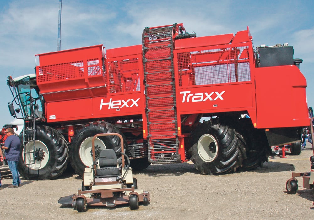
The attendee draw area for the Big Iron Farm Show held recently in Fargo includes millions of acres of land infested with rocks deposited by the glaciers. This makes Big Iron the perfect venue for TerraClear representative Ryan Frei to show off his company’s mapping and picking technology.
Rock Map — Farmers in nearly all regions of the Prairies have seen the mechanical devastation caused by a rock going through a combine. It’s expensive.
Most agree that if they knew exactly where the worst rock families lived, they would deal with the infestation before it caused major combine damage. The challenge is knowing the location of those bad spots. Randomly combing your fields searching for bad rock spots wastes a lot of time and doesn’t guarantee you’ll find the one that’s waiting for your combine.
That’s where the TerraClear system starts. Not only does the company’s drone identify your hot rock spots, it then classifies and colour codes them according to size and number. Plus, every rock you pick is digitally removed from the map once it’s in your bucket.
Frei explains this allows the farm manager to prioritize the rock removal operation, beginning with the worst areas. The farmer spends time and fuel picking rocks, not searching for them. You spend time and money fixing the problem, not looking for the problem.
Minimum size for the rock map service is 500 acres. Mapping cost is $3 to $4 per acre, depending on location. The mapping app is not available to farmers, meaning they cannot do their own rock maps. The maps are created either by a licensed third party, or by a TerraClear representative.
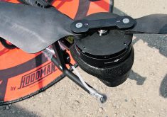
Rock Picker — The fun begins once you have the rock map loaded and head to the field. TerraClear engineers went back to their design table when tasked with designing a more efficient picker. Rock Picker does not use the conventional method of scraping or scooping.
The unique feature is the rock-tossing robot that uses three hydraulically driven rubber track belts to weasel under the edge of a rock, then send it flying up the conveyor belts and into the bucket.
The two bottom belts serve as a cradle to support and contain the rock as it’s propelled up the conveyor at a high enough speed to launch it. The top belt is also hydraulically driven, and serves to hold the rock tightly against the lower belts. This assembly can dig six inches into the dirt to retrieve a rock. The rock tosser slides 80 inches left to right on the leading edge of the bucket, letting the operator take accurate aim at each target before pressing the trigger.
Frei says belts need to be replaced after 150 hours, or about 50,000 rocks. Minimum hydraulic requirement is 18 g.p.m. at 2,900 p.s.i. Tipping load on the 1,600 pound picker is 5,600 lb. The three belts are guaranteed for one year. The machine can dump in stone piles, over fences or into trailers and trucks. It can only dump as high as the compact track loader’s ability.
The original TerraClear Rock Picker is the TC80, which lists for US$19,999. The new model shown at Big Iron is the TC100 and it lists for $29,999.