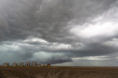

Hot dry weather continues across the Prairies, with low chance of precipitation in the immediate future for most regions.
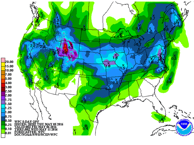
The following map from the U.S. National Weather Service was issued on Thursday afternoon and it shows accumulated precipitation five-day forecast for May 6 to May 11, and then the seven-day forecast May 6 to May 13.
As a system moves north out of Montana, Southern Saskatchewan may receive some rain in just under a weeks time.
Read Also

Mixed year for hail claims across Prairies: CCHA
The 2025 crop year was an average year for hail across the Canadian Prairies, with overall claim numbers down slightly compared to last year, reported the Canadian Crop Hail Association (CCHA).
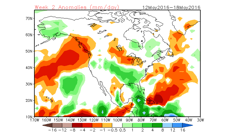
Looking a little further into the future, the following map from the U.S. Environmental Modeling Center at NCEP is produced from the mean of 16 forecast members
It displays its precipitation prediction for May 12 – 18, May 19 – 21, and May 26 – June 1. It shows a chance of rain on the Canada U.S. border on May 25 to June 1.
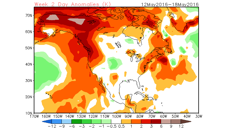
The following map is also from the U.S. Environmental Modeling Center at NCEP, it displays its mean temperature prediction for May 12 – 18, May 19 – 21, and May 26 – June 1.
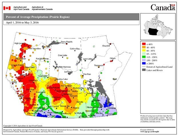
The following map is from Agriculture and Agri-Food Canada, and it displays the moisture accumulation April 1 to May 3 compared to normal.
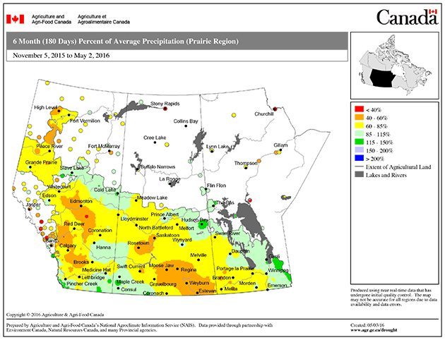
The following map from Agriculture and Agri-Food Canada displays the percent of average precipitation since Nov. 5.
This map shows the percent of average precipitation received on the Prairies since Feb. 3.