
Sask. considers diverting water from Big Quill and Little Quill lakes; opposition calls plan reckless
A proposed diversion project designed to lower water levels in Big Quill and Little Quill lakes is drawing criticism and has sparked a petition for more information.
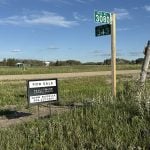
The Saskatchewan government is expected to decide later this fall on whether to proceed with the project. Record high water levels recently, have caused the two lakes to join, flooding farmland and threatening highways and a rail line.
But now some members of the public want more information about how the plan will affect other water bodies.
The opposition NDP said diverting saline water to Last Mountain Lake is reckless and won’t fix the problem.
Read Also
Volunteers help exotic animal farm rebuild
Exotic animal farm loses beloved camel and pony to huge hail storm that gripped the Brooks, Alta. area as a community member starts a fundraiser to help the family recover from the financial and emotional damage.
“It’s a really unique and challenging one for us,” said Patrick Boyle, spokesperson for the province’s Water Security Agency.
The agency contracted environmental consultants Golder Associates to assess the situation.
The Water Security Agency’s preferred proposal would divert water through Kutawagan Creek away from Big Quill and into Last Mountain Lake.
“The project itself essentially would mean berming one end of Kutawagan Lake and then creating a control structure on the creek on the other side and controlling that outflow, and when we have to release outflow from there to Last Mountain Lake, we’ll do that,” Boyle said. “We’re not draining the Quill lakes.”
There is evidence of a natural creek channel, but part of the project would be to develop it more fully.
The Quill lakes are considered near-terminal water bodies that likely naturally flowed to Last Mountain Lake in the past. However, no outflow has been recorded since the 1880s.
The last several years of flooding have put the lakes near natural spill levels. Highways 16 and 6, grid road 640 and the Canadian Pacific Railway line have all been threatened, and an estimated 85,000 acres of private and crown land have been flooded.
Boyle said natural evaporation during the heat and dry conditions earlier this summer were helping, but the rain that fell July 27 put the levels right back where they had been.
The diversion proposal has led to concerns about the quantity and quality of diverted water.
Boyle said in a peak flood year like 2011, the diversion would add seven centimetres to the peak on Last Mountain and one cm on the Qu’Appelle lakes downstream.
Water quality monitoring stations to measure total dissolved solids, or salinity, has shown the diverted water would contain 2,400 milligrams per litre of total dissolved solids.
“That’s much lower than the 8,000 mg per litre of total dissolved solids that would come naturally from the Quill lakes,” Boyle said.
However, that is at the high end of the naturally occurring total dissolved solid levels in Last Mountain, which are usually 900 to 1,500 mg per litre but have been as high as 2,500, he said.
The Water Security Agency is continuing to run models to better understand the impacts that adding higher amounts would have.
Boyle said federal and provincial approvals are required.
The province would have to seek an emergency exemption if it wanted to move ahead this fall.
“If we were granted an exemption, we would still have to do the full assessment and mitigate any damages, but we could construct the project before the assessment is complete,” he said.
He also said information on other options the agency has considered is available on its website.
Boyle said the Kutawagan Diversion was selected because it seemed to best address the concerns of all stakeholders.
karen.briere@producer.com
- Big and Little Quill lakes average 500 sq. kilometres.
- Big Quill’s mean depth is 1.5 metres.
- The lakes and surrounding wetlands are an important breeding ground for migrating birds.
- The Ramsar site was the first in Canada to be implemented under the North American Waterfowl Management Plan in 1987.
- The lakes were named for the bird quills collected and shipped to England for use as writing pens.