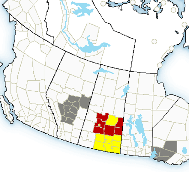
Environment Canada meteorologists on Thursday afternoon are tracking a line of severe thunderstorms in central and southern Saskatchewan capable of producing very strong wind gusts, quarter to toonie size hail and heavy rain.
Watches and warnings have been issued.
Golf ball sized hail was reported east of Kenaston and toonie sized hail near Warman. Some of the thunderstorms along the line have begun to weaken and the line is moving slowly eastward.
Take cover immediately, if threatening weather approaches.
Environment Canada also says a soggy change in the weather is on the way for a large part of central Alberta.
Read Also
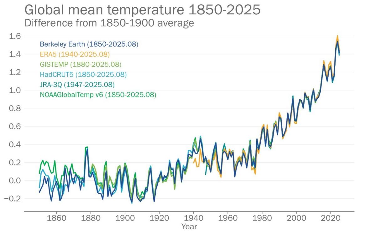
2025 set to be among hottest years on record: WMO
With only two months remaining in the year, 2025 is set to be among the top three hottest years on…
However, some uncertainty exists in both the rainfall amounts and the exact location of the rain swath. In addition to the rain, strong northerly winds, perhaps gusting as high as 80 km/h, are likely to accompany the already dreary day. Winds and rain will abate on Friday afternoon or evening.
As the rainfall event nears and uncertainty in location and amounts decreases, it is likely that rainfall warnings will be required for some portions of central Alberta.