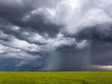
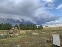
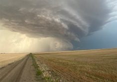
Hail is probably the most feared and costly type of severe summer weather. If you’ve lived any significant amount of time on the Prairies, you have likely experienced a hailstorm.
While hail can occur anywhere across North America, there are two main regions where incidence is significantly higher — the central United States and the Canadian Prairies, particularly Alberta.
I have a number of weather pet peeves and one of them has to do with hail, or rather, the improper use of the term “hail.”
Read Also
Canola oil transloading facility opens
DP World just opened its new canola oil transload facility at the Port of Vancouver. It can ship one million tonnes of the commodity per year.
Hail refers to the falling of ice from a cumulonimbus cloud. Ice pellets, snow pellets and graupel (a snowflake coated in ice) are not hail and should not be called hail. These types of precipitation often occur in spring or late fall and are not associated with thunderstorms. You need a thunderstorm for hail to occur.
Can it be too warm for hail? Yes. If the upper atmosphere is warm, the freezing level in the atmosphere is very high up. If a thunderstorm does develop, and if hail forms in the storm, the hail will melt before it reaches the ground.
The key ingredient for hail formation is plenty of cold air aloft that is not too high off the ground. This is one reason Alberta and higher elevations of the U.S. Midwest experience more hail. The higher elevation often means the freezing layer is lower to the ground, resulting in a greater chance that hail will not melt as it falls.
Most thunderstorms will produce hail. The question is whether it will grow large enough to reach the ground without completely melting. A very low freezing level helps because the hailstone only has a short distance to fall through relatively warm air.
Alberta sees more hail than everywhere else in Canada because of its topography. While ground temperatures can be really warm, the freezing layer is not that high up.
Hail forms when a particle passes from the warm (liquid) part of the cloud into the cold (freezing) part of the cloud. When this occurs, any water on the particle freezes, creating a small hailstone.
For hailstones to get really big, they must go back into the warm (liquid) section of the storm, pick up more water, then go back up into the cold section of the cloud so the water can freeze. Repeat this cycle a number of times and big hailstones result.
Picture an old-fashioned bingo machine. The balls, or hail stones, are continually moving up and down due to the strong updraft.
It’s hard to understand how strong an updraft is needed to keep a hailstone in the air. An AI chat program came up with these numbers. A 250-gram object — a little smaller than the Canadian record of 292 grams — would require an updraft of about nine metres per second. That’s an updraft of about 32 km-h.
Updrafts in thunderstorms are often in the 10 to 20 metres per second range (36 to 72 km-h) and can approach 40 (144 km-h), which is enough to keep even the heaviest hailstones in the air.
What limits the size of a hailstone? It is the size or area of the updraft and its duration because these two things determine how long the stone remains in the updraft.
When it comes to hail, size really does matter. Pea-sized hail will do little if any damage to structures or plants, while golf-ball sized hailstones can destroy everything in their path.
When it comes to measuring hailstone size, things get a little strange. You don’t usually hear that hail was around 50 millimetres in diameter. Instead, you hear it was the size of a golf ball or an egg.
Daniel Bezte is a teacher by profession with a BA in geography, specializing in climatology, from the University of Winnipeg. He operates a computerized weather station near Birds Hill Park, Man. Contact him at daniel@bezte.ca.


