Steve Shirtliffe’s research shows that aerial imagery isn’t just for farm yards, it can serve a crop production purpose.
People sometimes have the wrong idea about what satellite imagery can do for agriculture, says Steve Shirtliffe, a researcher and professor in the department of plant sciences at the University of Saskatchewan. “I think there’s this idea sometimes that people think that you can just have a bunch of satellites flying around taking pictures, and […] Read moreTag Archives Steve Shirtliffe

Taking a close look from a long distance
Satellite data and machine learning are yielding powerful tools for crop management in Western Canada
SASKATOON — Information is power, and by putting that power into farmers’ hands, Steve Shirtliffe wants to help Western Canada continue its record of world-leading innovation. “My vision is that we build a digital agriculture economy here in Saskatchewan,” he said. “ We’ve done it before. Where did no till come from? Where did people […] Read more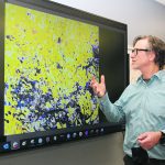
Risk evaluation app predicts lentil disease
Growers are tempted to shorten their rotation because of high profit potential but the biggest enemy of lentils is aphanomyces root rot. Its spores can remain viable in the soil for a decade or longer.

