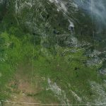
Saskatchewan’s crops look better from the sky than they do from the ground. Statistics Canada used satellite-based vegetative growth maps to determine crop yields in its August principal field crop estimates report published on Sept. 14. By contrast, Saskatchewan Agriculture used a boots-on-the-ground approach to determine yields as of Sept. 5. The different methodologies resulted […] Read more
Tag Archives satellite imaging

Free satellite images help in Ukraine
European company works to provide farmers in war-torn country with better information as Russian invasion continues
OneSoil, the European satellite imaging company willing to provide free services to every farm on Earth, is actively working with Ukrainian producers to provide them eye-in-the-sky visual precision agricultural images. Launched in Minsk, Belarus, in 2015, OneSoil is dedicated to bringing free satellite information to any farmer anywhere who wants it. It uses public data […] Read more
OneSoil gets serious about prairie market
In its quest to provide free high-quality images to the world’s precision agriculture farmers, OneSoil did not overlook the Canadian Prairies. It recently hired a field staff member to cover Western Canada. Kyle Hoyda, who spent his childhood raising cattle and growing grain north of Edmonton, has worked in Canada, Australia and the United States […] Read more

Satellite imagery helps boost crop production
Ukrainian farm says precision agriculture technology helps it offset lost yields due to an inability to seed all of its fields
Farming has always had its occupational hazards, but the dangers have increased significantly this year for farmers in Ukraine. “We have 120,000 hectares of land, with the majority in the Chernihiv, Poltava and Sumy regions,” says Oleksii Misyura head of research and development at IMC, one of the largest agricultural holdings in Ukraine. “We didn’t […] Read more
Satellite pictures into milk pitchers
Dairy farmers call it “star grazing” because their pastures twinkle with the green glow of health
The word “cropland” pops up when we think of satellite images used in precision agriculture. But an American dairy co-op uses Planet Labs PBC satellite images to manage 189,000 acres of organic pasture. Organic Valley Pastures has 1,500 organic dairies spread across the United States, with 200 in their second season on the intensive precision […] Read more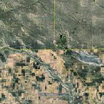
Years of detailed satellite imagery for free
An app that evaluates the risk of aphanomyces in prairie fields has been developed at the University of Saskatchewan. It recently received funding from Saskatchewan Pulse Growers. “It’s a working project but we’re quite happy with the way it works and we hope producers use it to lower their risk of aphanomyces root rot,” said […] Read more

Invasion impacts images and agronomy
Last winter at this time The Western Producer featured a startup satellite imaging company called OneSoil, based in Belarus. OneSoil has since left Belarus and moved to Switzerland and Poland. On March 4, 2022, The Western Producer conducted a Zoom interview with OneSoil chief executive officer Morten Schmidt, who said that, while OneSoil satellite imaging […] Read more
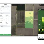
What is OneSoil?
OneSoil’ s access to satellite information enables it call up any farm in the world in a matter of minutes. They do this using free public data from the European Space Agency, with high-quality 10-metre resolution. With this data, the team builds advanced image processing technologies. Initial image processing takes three or four days, but […] Read more

Taking ground data from the sky
Wyvern spends time working on understanding what prairie crop plants are saying through hyperspectral readable emissions
A Canadian start-up is developing satellites that use high-resolution hyperspectral imagery to monitor and improve broad-acre crop production. Chris Robson is the chief executive officer of Edmonton-based Wyvern, and he said the optics the company plans to launch on the satellite next year will enable a different kind of image analysis that opens new possibilities […] Read more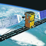
Remote sensing of agriculture reaches new heights
Agriculture Canada has funding to update the Disease Risk Tool (DiRT1) it developed in 2016 to include crops beyond canola. DiRT1 combines information from satellites and user inputs into a prototype web application that can be used to investigate the accuracy of crop-disease forecast models. “In this first prototype we also integrated geospatial data from […] Read more

