
Satellite technology may be the answer for providing cattle producers with forage insurance comparable to how multi-peril insurance works for grain farmers.
Collaboration is occurring between Agriculture Canada, the three prairie crop insurance agencies, the Canadian Cattle Association, the Saskatchewan Stock Growers Association and Global Ag Risk Solutions (GARS) in an effort to make satellite-based forage insurance a reality.
GARS is known for its margin-based insurance offering for grain producers. In recent years, it has expanded into data science and analytics and is doing the work to refine satellite imagery into a usable insurance product.
Read Also
Invigor Gold variety viewed as threat to condiment mustard
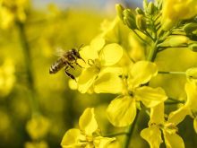
Invigor Gold, the canola-quality mustard developed by BASF, is on a collision course with Canada’s condiment mustard industry. It’s difficult to see how the two can co-exist.
The current forage rainfall insurance program in Saskatchewan is fraught with difficulties. The insurance is based on rainfall data from weather stations. Unfortunately, even with increasing the number of stations to over 180, a station can still be 30 or more miles from the forage being insured.
Producers typically pick two or more weather stations to hedge their bets. A big localized thunderstorm at a location could easily skew the insurance. Producers also need to weight the rainfall amounts by month as to their percentage of total coverage. Some producers have said it feels more like playing roulette than buying insurance.
Damon Johnson, the director of strategic projects for GARS, says the satellite technology isn’t meant to measure rainfall. It measures the vegetative index and compares to the historical norm.
As everyone knows, a lot of factors go into plant growth in addition to rainfall. Did late spring frosts affect growth? How much snowmelt infiltration occurred? Were rainfall amounts timely? What were temperatures like? By measuring vegetative growth rather than just rainfall, the insurance should be much more relevant.
The other important aspect is localized detail. Johnson says there are about 7,500 townships of productive land in the three prairie provinces. That land mass is broken down into 40,300 mesh grids of satellite imagery. Rather than relying on data from a weather station many miles away, the imagery can capture a relatively small area containing your actual land.
Of course, all this high-tech wizardry is only impressive if it actually works, which means matching the vegetative index information to what producers actually see on their land. Johnson says with lots of ground truthing, accuracy is about 90 percent.
The final report to the group from GARS is slated for January. The droughts of recent years have provided urgency to the project. As Johnson says, you should never waste a crisis.
If all goes according to plan, a pilot project will be launched in 2024 with possible roll-out of an insurance offering in 2025.
Government-supported production insurance products for the livestock industry have never been well-regarded or widely adopted. The multi-peril insurance offering for the grain sector certainly isn’t perfect, but most producers are enrolled and in years such as 2021, the payouts have provided a huge level of support.
Satellite technology could also be used to develop an insurance product for crop production, but the current system using actual producer yields is unlikely to be changed soon.
The grain sector hasn’t had to lobby for ad hoc assistance through AgriRecovery, while the cattle sector has had to go the AgriRecovery route two of the past three years. It’s far better to have a workable, accurate, government-supported insurance program than to rely on the political uncertainty of a loosely defined safety net.
Here’s hoping satellite forage insurance is a success.
Kevin Hursh is an agricultural journalist, consultant and farmer. He can be reached by e-mail at kevin@hursh.ca.