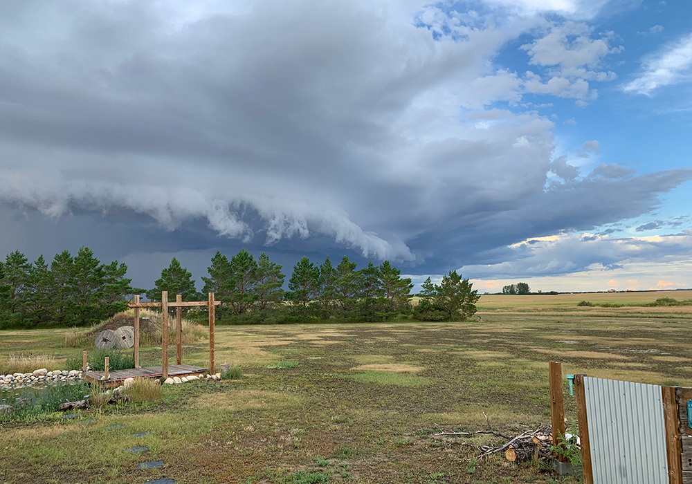
The Prairies have seen unsettled weather in the last month, including several outbreaks of heavy rain, strong wind, hail and even tornadoes, so it is a perfect time to continue a discussion of thunderstorms.
Let’s look at what turns a garden-variety thunderstorm into a severe thunderstorm or even a thunderstorm that you truly remember.
Typically, there is a hot humid air mass at the surface, which rises, and the air a few thousand metres up is very cold. Add to this a strong jet stream overhead that will vent the accumulating air at the top of the storm, and we are ready for severe thunderstorms.
Read Also

Alberta researcher helps unlock the economics of farming
Lethbridge Polytechnic researcher helping agriculture producers with decision-making tools in economic feasibility
Over the last few weeks, the region has had plenty of cold air aloft, but not a lot of hot and humid air at the surface. There was just enough heat and humidity at the surface to generate rising air. Combine this with several occurrences of strong jet streams overhead and we saw severe thunderstorms develop.
What can Mother Nature add to the mix to make things worse?
The first and probably most important extra ingredient is to have the wind change direction with altitude. Remember that the atmosphere is three-dimensional. Air can flow horizontally, but this horizontal direction can change as it moves upward. Why would this have an impact on our storm?
This change of direction can cause the developing storm to rotate. Picture what would happen if you took a rising parcel of air and pushed on it from the south, when it is at the surface. Then, as it rises a couple thousand feet, the wind switches and blows from the east. Then a few thousand feet further up, it blows from the northwest.
The rising parcel of air would start to rotate.
If air rotates counterclockwise, it will start to create an area of low pressure. Air spirals inward in a counterclockwise rotation. This means it will bunch up near the centre of this rotation and can move up or down.
However, there’s a bias toward upward movement. The ground acts as a barrier, plus the air is unstable, which means it already wants to move upward and can do so very quickly.
The air gets moving, and the rotation forms a small-scale area of low pressure that lets it rise even more than it otherwise would. When this occurs, it’s known scientifically as a mesocyclone, but is more commonly called a super cell thunderstorm.
The second thing a rotating thunderstorm can do is cleanly separate areas of updrafts and downdrafts. This is important, since the downdrafts, even with a severe thunderstorm, will eventually cut the updrafts off from their source of warm moist air. Once this happens, the storm quickly weakens.
In a rotating thunderstorm, the source of warm moist air is maintained, giving these storms a long life and a lot of moisture to produce heavy rains.
A rotating column of air can provide conditions for tornado formation. While we do not fully understand this process, we know rotating thunderstorms can often produce tornadoes.
One theory is that rotating columns of air get squeezed into a narrower shape. As this happens, wind speeds increase, eventually producing the tornado.
It’s the theory of conservation of angular momentum. Take a large thing that is spinning slowly, like a big wide column of air, and shrink it down. The object’s rotational speed must increase. The classic example is a spinning figure skater pulling in their arms to increase their rate of rotation.
Like most things in nature, thunderstorms rarely behave like the textbook indicates. Even when all ingredients are there, no storms may form, or sometimes a key ingredient is missing, yet we get a really severe storm. This is what makes weather so interesting.
Daniel Bezte is a teacher by profession with a BA in geography, specializing in climatology, from the University of Winnipeg. He operates a computerized weather station near Birds Hill Park, Man. Contact him at dmgbezte@gmail.com.