WINNIPEG (Staff) – Has the lingo of satellite technology got you seeing stars?
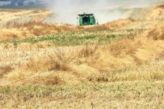
There are several high-tech tools in the earth observation toolbox that combine to create products such as automated maps.
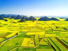
- Remote sensing uses data collected by satellites to create an image of the earth’s surface.
- Computer software can work that image into a map format.
- A global positioning system can correct and adjust the map as needed.
- Using thematic maps, a geographic information system, commonly known as GIS, can be developed to provide information about the relationships between variables on the map, or predict what will happen in a particular area over time.