How can you know if a storm is capable of producing severe weather?
The answer is not easy. First, listen to Environment Canada for watches and warnings. It is the only entity allowed to issue watches and warnings in Canada.
A watch means the potential exists for severe thunderstorms, but they have not yet developed in your area. When you hear there is a watch, watch the sky and if storms do develop, they have potential to become severe.
If a warning is issued, it means a thunderstorm with some or all characteristics of a severe storm have developed and have been confirmed by eyewitness or radar. You should take precautions immediately.
Read Also

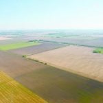
Crop quality looks good this year across Prairies
Crop quality looks real good this year, with the exception of durum.
If you are out in the field, you will usually have access to data from Environment Canada and be able to check radar, but it is good to simply watch and understand the signals Mother Nature gives.
First, recognize the conditions. How warm and humid is the air? Remember, a moist atmosphere means a lot of energy is available. Look for a dark or threatening sky. Look closely at the area between the storm and the ground. If you can see through it, the storm is likely not severe yet. Lots of lightning or nearly continuous thunder is a good indication of a severe storm.
As the storm approaches, watch for a green sky and mammatus clouds — those that look like bag-like sacks that hang beneath another cloud. These conditions usually indicate the storm contains huge amounts of water and has very strong updrafts and downdrafts.
Finally, watch for any rotation within the storm. This means it has become very strong and is capable of producing a tornado.
If you have access to radar, you can see the location of the storm and how it is developing. Look at the last hour to three hours of data by playing the radar loop. This will show the motion of the storm and indicate whether it is developing or weakening.
For most people, the word tornado brings a feeling of awe and even a little fear. Unless they have already witnessed a tornado, many weather watchers secretly wish they could safely experience the awesome beauty and power of a such an event.
Worldwide, Canada is second only to the United States in the number of tornadoes that occur each year, with an average of about 70. Southern Ontario experiences the highest number, followed by southern Manitoba, Saskatchewan and central Alberta. However, tornadoes have occurred in nearly all regions of Canada.
There are several theories on how tornadoes develop, and more research is being done as technology and storm chasing become more sophisticated. We don’t have a definite answer due to the size and nature of tornadoes.
The first problem is that tornadoes form in thunderstorms, and while we are getting better at predicting where thunderstorms will develop, we are not yet accurate. Saying a storm will develop in southwestern Manitoba is pretty good, but that is still a large region.
The other problem is the size of the storms. Some are small, measuring only a few sq. kilometres, while others can be hundreds of sq. km.
As well, conducting research within a severe weather environment is extremely difficult, not to mention dangerous, which of course means it is expensive.
Daniel Bezte is a teacher by profession with a BA in geography, specializing in climatology, from the University of Winnipeg. He operates a computerized weather station near Birds Hill Park, Man. Contact him at daniel@bezte.ca.