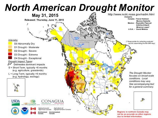
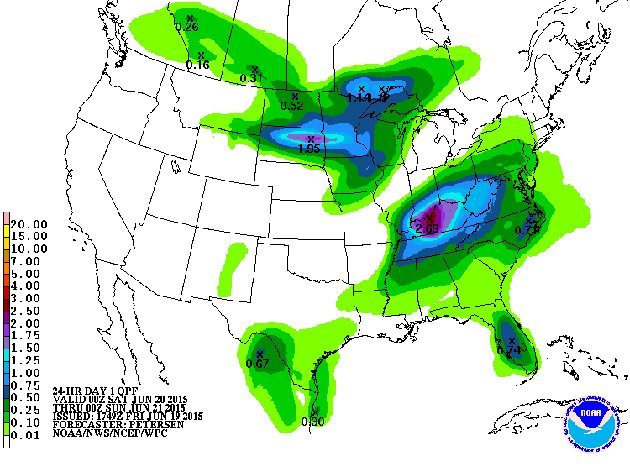
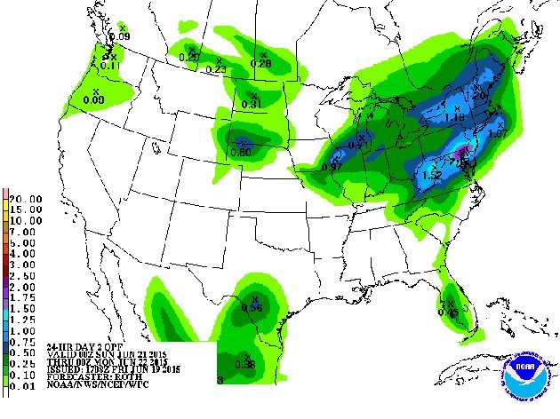
The U.S.Weather Service Weather Prediction Center today issued these precipitation forecasts. Drought affecting the western Prairies continues to be the biggest issue of the 2015 cropping season.
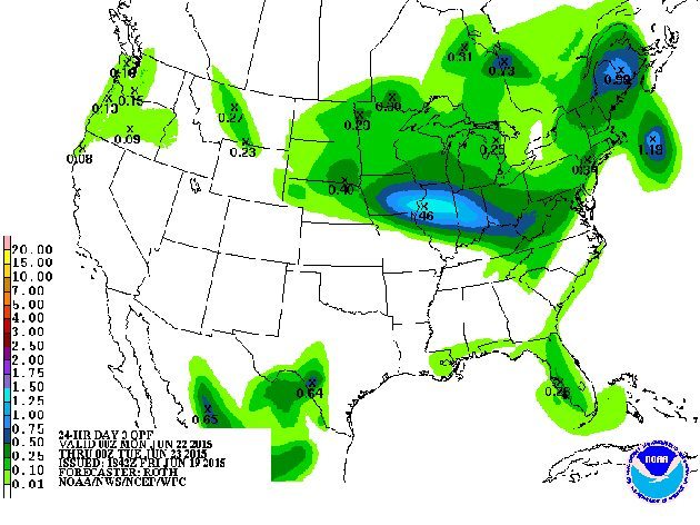
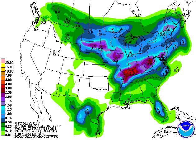
There is rain in the forecast for many of the drought affected areas, however the accumulation looks insufficient compared to what is needed. The largest accumulations in Western Canada are forecast for southeastern Saskatchewan and southwestern Manitoba. The scale is in inches. Green areas indicate accumulations of less than a half inch.
The first map is for Saturday.
This is the Sunday forecast.
This is the Monday forecast.
This is the forecast for five-day accumulations to next Wednesday
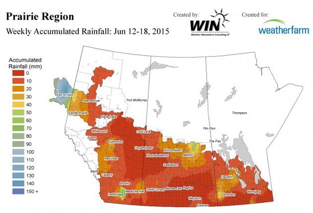
The following historical map shows the accumulated rainfall in millimetres from June 12 to midnight June 18.
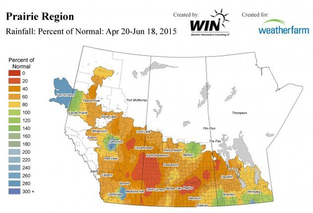
This map shows the percent of normal rainfall for the past 60 days.
The following is a collaborative project of Canadian, American and Mexican agricultural and weather agencies.