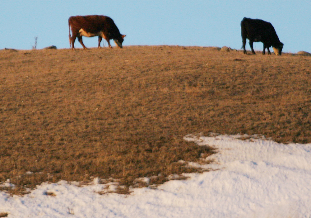
A warm start to spring this year resulted in some very early dates for the last spring frost, and a warm first half of fall made for some late first fall frosts. This resulted in a remarkably long frost-free season.
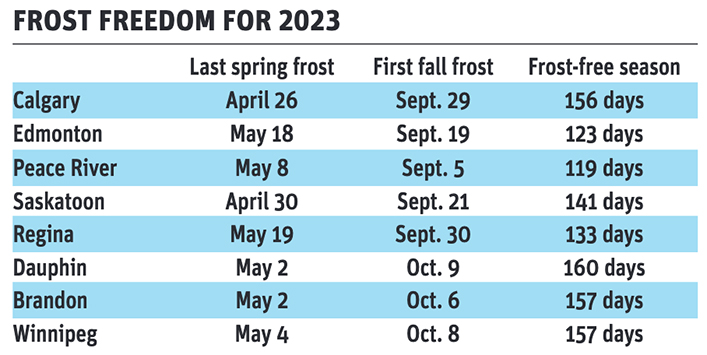
While I don’t have all the data for the longest frost-free seasons, the 156 days in Calgary, thanks to a very early last spring frost, is well beyond the average of about 115 days and is likely in record territory.
The numbers from Saskatchewan are also impressive but not likely to be records. In Manitoba, all three sites had extremely long frost-free seasons and Winnipeg tied its record for longest season set in 1960.
Let’s look at October’s weather numbers. In Alberta, where temperatures dipped into the -20 C range on a few nights at the end of the month, average monthly temperatures were near average.
Across Saskatchewan, the same pattern played out. Regina and Saskatoon reported mean monthly temperatures around 4.1 C, about average for both locations. Precipitation was below average around Regina, with about 15 mm reported, compared to the long-term average of 25 mm. Saskatoon reported around 20 mm of water-equivalent precipitation, near to slightly above average.
Manitoba was the prairie hot spot in October, as it was the last to see the cold air. All three locations reported mean monthly temperatures either right around or above average for the month.
Overall, October was a near average month across the western and central Prairies with above-average temperatures over eastern regions. Precipitation was near to above average in the east and across southern Alberta, with near- to below-average amounts elsewhere.
As for computer models, NOAA’s latest three-month forecast, extrapolated northward, calls for above-average temperatures and below-average precipitation, with western regions having the best chance of those conditions.
The CFS’s latest three-month forecast calls for above average temperatures with near average precipitation and the chance of above-average amounts in southern Alberta.
The CanSIP model also calls for above average temperatures and near average precipitation, this time with eastern Manitoba possibly seeing above average precipitation.
The ECMWF does not follow other weather models. It calls for near average temperatures to end the year, with the eastern Prairies possibly seeing above average temperatures. Its precipitation forecast calls for near average amounts over the western half of the Prairies and above average amounts over the eastern half.
My throw at the weather dartboard: I lean toward a warmer than average end to 2023, with the best chances of above average temperatures over the western half of the Prairies. Precipitation is the toughest to predict, but looks to be below average in the west and near to above average in the east.