We spent the last several issues exploring the three main factors that could influence the weather this winter and then pulling everything together and looking at what various forecasters are predicting for the months ahead.
In this issue, we are going to take a quick look back at how October shaped up across the Prairies — are we already seeing the forecasted winter weather pattern developing?
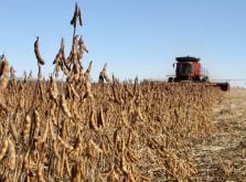
Sticking with our usual format, October continued the trend we saw in September, with a much warmer-than-average month across all the regions.
Read Also
Rural officials hopeful strychnine use will resume
The Saskatchewan Association of Rural Municipalities is taking a verbal commitment from the federal agriculture minister on strychnine use as a good sign.
Alberta reported mean monthly temperatures about 1 C above normal. As we move eastward, conditions grew even milder, with Saskatchewan seeing averages roughly 2 C above normal. Manitoba topped the list for warmth, with temperatures running between 3 and 4 C higher than average.
The warmest spot in the region turned out to be Winnipeg, where the mean monthly temperature came in at 8.7 C, an impressive 3.7 C above the long-term average.
The coolest of the major reporting stations was Peace River, Alta., which recorded a mean of 4.1 C, which was still 1.3 C warmer than usual.
When it comes to precipitation, the story was more varied.
October ended up wetter than average across much of the southeastern and northern Prairies. Southern and eastern Manitoba saw particularly high totals, with those wetter conditions extending northwestward into north-central Saskatchewan and northeastern Alberta.
Winnipeg was the standout, reporting 93.7 millimetres of precipitation, which was nearly 60 mm above normal for the month.
At my own location just north of Winnipeg, I measured more than 135 mm during October.
At times it felt more like spring runoff than autumn rain. The ground was saturated, ditches were full and I even had to set up pumps to help move some of the water off the property.
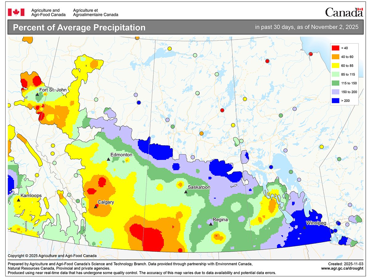
In contrast, areas farther south and west were much drier. Regina reported only 28 mm, and precipitation dropped sharply from there, with parts of southwestern Saskatchewan and southern Alberta seeing totals close to zero.
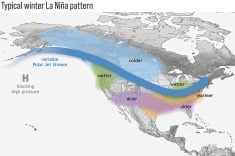
As discussed in the last issue, most long-range outlooks continue to suggest that western parts of the Prairies will experience a warmer and drier-than-average winter. Meanwhile, eastern areas are more likely to see average to below-average temperatures along with near to above-average precipitation.
So far, that pattern appears to be emerging, at least where precipitation is concerned. The western Prairies have remained relatively dry, while the eastern sections have seen more frequent storm activity.
Whether this trend will hold through the rest of the season remains to be seen. Winter is known for surprises, and Mother Nature often has a way of rewriting the script just when we think we’ve figured her out.
As we all know, in this part of the country, it only takes one strong Arctic outbreak to remind us just how quickly things can change.