AIRDRIE, Alta. – The growth of Alberta is a tale of two regions.
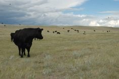
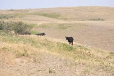
Phenomenal population growth is happening through the centre of the province, while the nether regions encounter a changing rural landscape in which people leave farms that are worth more for their real estate value than for food production.
“We have to understand we have two ends of the spectrum happening at the same time on the same landscape. That causes a lot of problems for regional planning,” said Guy Greenaway, acting director of Miistakis, a non profit corporation affiliated with the University of Calgary that supports research into the ecosystems of the Rocky Mountains and surrounding regions.
Read Also

India slaps 30 per cent import duty on yellow peas
India has imposed a 30 per cent duty on yellow pea imports with a bill of lading date on or after Nov. 1, 2025.
Alberta growth is not a new issue, but conflicts have occurred on a regular basis in recent years.
“We are on a trajectory which started some time ago,” Greenaway said in Airdrie on March 16 during the annual meeting of Action for Agriculture, a rural group dedicated to preserving farmland.
Of particular concern is the relentless gobbling up of land for urban development.
Between 1971-96, the amount of Alberta land taken for urban use increased 132 percent. Only Prince Edward Island lost a higher percentage of land for urban development, although the number of acres was smaller.
In the most recent national census, Alberta’s population grew 10.6 percent since 2001 to more than 3.2 million people. The rest of Canada grew about five percent.
While Calgary grew by 13.4 percent and Edmonton by 10.4 percent, the real growth is in smaller areas such as Sylvan Lake, Strathmore, Lakeland County, the Municipal District of Foothills and Lacombe County.
Among mid-sized urban centres such as Grande Prairie, Airdrie and Okotoks, growth is among the highest in the country. Okotoks, for example, grew from 11,670 people in 2001 to 17,145 in 2006.
However, the amount of land lost is not in proportion to the population growth and more groups are calling for greater density on smaller parcels.
More farmland is being used for rural residential developments that have been increasing since the 1940s in southwestern Alberta. The land never returns to agricultural production.
While regional groups are talking about land use planning in Alberta, there is no comprehensive overview. The province is promising a land use plan and regional meetings are underway.
“We have some opportunities that exist to start working on the issue of land use planning before it is entirely too late,” Greenaway said.
The Alberta experience is not unique, said Robert Grow, who has been involved for more than a decade in a planned growth initiative for Utah.
“There is no greater clash than what you are experiencing here, and it is being experienced in every growing metropolitan area in the country,” he said.
Utah took on a process called envisioning to accommodate different choices and interests in planning land use.
“You have got to start the dialogue, and it has to be a balanced dialogue that looks at all the choices,” he said.
Utah decided something had to be done because it is the fifth fastest growing state in the United States and second fastest job producing state.
Air quality was at stake and no one knew if there was enough water to sustain a possible population of five million by 2050. Commutes were growing longer and traffic was nightmarish.
The Envision Utah group was pulled together in 1997 and agreements were reached, but no one had a vote.
This prevented a powerhouse group such as the City of Salt Lake from overshadowing everyone else.
Groups were also forced to look at the big picture.
“All the groups tend to think their issue is the most important and that they are handling it well,” Grow said.
Other American states are trying the envision approach with varying results.
The Utah experience brought together municipal councils, public groups and planners, which had to learn co-operation and trust.
Together they had to take a broad look into the future and the consequences of different development proposals.
Some of this can be done with new computer models that look at transportation corridors, environmentally sensitive areas, land use, air quality, agriculture land, water use, open spaces and commuter distances in a 25 to 50 year scenario.
The end result was a light rail transit line made possible by a municipal sales tax approved by Salt Lake City voters.
It now carries three times more people than originally projected and more lines are being built.
The state bought 280 kilometres of rail from Union Pacific and created nine future transit corridors.
The goal is to put 960,000 people within 1,000 steps of a transit stop. So far, about 320 miles of land that could have been swallowed up for suburbs and roads have been saved.
“We changed the way we are growing,” said Grow.