La Niña isn’t moving out of the house anytime soon.
Cool water temperatures in the Pacific Ocean began in September 2020 and will likely continue into the fall and winter, says the World Meteorological Organization.
That could mean a colder than usual winter for the Prairies.
Read Also

Using artificial intelligence in agriculture starts with the right data
Good data is critical as the agriculture sector increasingly adopts new AI technology to drive efficiency, sustainability and trust across all levels of the value chain.
“La Niña conditions in the tropical Pacific have persisted and strengthened as trade winds intensified during mid-July to mid-August 2022,” the WMO said Aug. 31. “It’s likely that these conditions will continue at least for the remainder of 2022.”
The WMO has forecast a 70 percent probability of La Niña persisting this fall and a 55 percent chance of it continuing through December to February.
If the forecast is correct, it would be the third consecutive winter in the Northern Hemisphere with a La Niña and that would be rare event. It has only happened three times since 1950.
La Niña is the large-scale cooling of ocean surface temperatures in the central and eastern equatorial Pacific Ocean.
Those cooler surface temperatures can impact weather patterns and atmospheric circulation in North America.
“In Canada, climatic anomalies during the winter months include: above average precipitation in British Columbia; colder-than-normal temperatures in the Prairies; and above average precipitation in Ontario and Quebec,” Environment Canada says on its website.
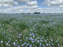
That pattern was definitely true last winter. It was an exceptionally cold and long winter in Western Canada, especially on the eastern Prairies. Brandon, for example, had 13 days in February where the temperature dipped below minus 30 C.
The cold temperatures and snow were beneficial for a large portion of Western Canada, which suffered through a major drought in 2021. But some parts of the Prairies remain dry, so a longer, colder and possibly snowier winter could be helpful for the 2022-23 growing season.
The U.S. National Oceanic and Atmospheric Administration (NOAA) is also expecting La Niña to continue into the winter.
In August, NOAA said “equatorial sea surface temperatures (SSTs) are below average across most of the Pacific Ocean. The tropical Pacific atmosphere is consistent with La Niña.”
For the September through November period, Environment Canada has predicted normal to slightly above normal temperatures in Western Canada. In Southern Ontario and eastward to the Maritimes, it is forecasting an autumn that’s warmer than normal.
Contact robert.arnason@producer.com