Unusually warm weather this month is dampening the alarm bells over severe flooding in Manitoba’s Red River Valley.
“It’s not bad, this weather. It’s actually favourable. We haven’t had much precipitation at all in the last month in Manitoba,” said Alf Warkentin, the province’s chief flood forecaster with Manitoba Water Stewardship.
“There’s still a pretty significant event developing in the Red … but as long as we don’t get a lot more rain, it shouldn’t be too bad.”
Read Also

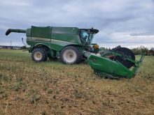
Powdery mildew can be combine fire risk
Dust from powdery mildew can cause fires in combines.
However, Warkentin couldn’t estimate crest height or date for the peak flow on the Red River because provincial hydrologists were still working through the data on deadline for this issue.
Warkentin said 2010 is unlikely to repeat 2009, the second worst flood in Manitoba’s history in terms of peak flow on the Red River.
The high waters last year forced hundreds of residents to evacuate their homes in the valley and closed sections of Highway 75, the main route between Winnipeg and the U.S. border, for several weeks.
Last year, there was a melt in mid-March followed by two weeks of cold weather, Warkentin said, delaying the flood water peak until late April.
“Many of the floods we’ve had in the past have been late floods,” Warkentin said, adding a big part of the story in 2009 was persistent ice ice jams on the Red.
“I don’t think we’ll have all the icing problems we had last year.”
Chances of a major flood in Manitoba may be dwindling, but worries remain south of the border in Fargo, North Dakota.
As of March 15, the U.S. National Weather Service (NWS) was predicting the Red to crest March 20 in Fargo at 11.5 metres, which would be the third highest water level in the city’s history.
Last year, when international media flocked to Fargo to report on flooding in the city, the river hit a record peak of 12.4 metres.
“Fargo is rapidly throwing up their emergency levies,” said Greg Gust, warning co-ordination meteorologist with the NWS in Grand Forks.
Gust said Fargo had prepared one million sandbags in early March to prevent a repeat of last year when residents and volunteers scrambled to fill enough sandbags.
After the peak passes through Fargo, Gust predicted the flood waters would affect farmers further down the Red River Valley, between Grand Forks and the U.S.-Canada border.
“We’re expecting to see the river slow down and get very wide, several miles across, so a lot of farmland will be inundated.”