Field scouting is the most important part of an integrated weed management program. It’s impossible for farmers to know which weed control strategies to try until they know which weeds they are dealing with.
Scouting is easiest if farmers carry some basic tools and equipment into the field with them, including a clipboard with scouting forms, field maps, hand trowel, sharp knife, hand lens, plastic and paper bags for collecting samples of unknown weeds, bag labels, a one-quarter sq. metre hoop sampler and pencils and markers.
Optional extras that can make the work more efficient include a pocket calculator for calculating weed densities and a GPS unit. GPS units are useful for marking the location of weed patches, which makes it easier to monitor the effectiveness of the weed control program.
Read Also
Manitoba farmers fight sprouted wheat after rain
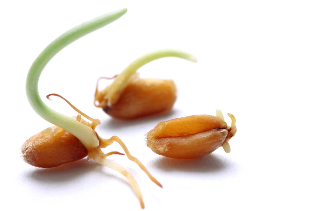
Rain in mid-September has led to wheat sprouting problems in some Manitoba farm fields.
It’s also a good idea to keep basic weed reference guides in the vehicle.
Follow these steps to monitor weeds in field crops:
- Walk a zig-zag pattern through the field, stopping at least five times at widely separated points along the way. Your pattern should take you across the entire field and allow you to finish where you started. Remember that some weeds may be concentrated in low, wet or saline spots in the field or along field margins. If such weeds are a problem, adjust your sampling accordingly.
- While walking through the field, identify all weed species that are present and record the growth stage of each species, especially if herbicide controls are being considered. Note the condition of the crop and record its growth stage. A good crop stand that is more advanced than the weeds is more competitive and suffers less yield loss.
- If weeds appear to be concentrated in specific areas of the field, draw a map of the field and mark their locations. Making a field map of these weed patches will make future weed control planning easier. Hand held GPS units are useful for weed mapping. Mapping will also help determine the extent of the weed problem over the whole farm and calculate control costs and potential rotational crops.
- Determine the number of weeds that are present at each field stop. For best results, take four or five samples at each of the five major field stops. Randomly take the samples by tossing a one-quarter sq. m count hoop or a brightly coloured ball into the field. Tie bright ribbon to the count hoop or paint it a bright colour to make sure you don’t lose it in the field. This will give you a total of 20-25 counts per field.
Consider taking more samples if the field is larger than 100 acres or non-uniform with many low spots and hills. With this data, you will have an excellent picture of all the weed problems in a field.
- After all counts have been taken, total the count for each weed and divide by the total number of counts. This will give the average number of weeds per one-quarter sq. m. Multiply this number by four to get an average number per sq. m. Most threshold information for weeds is based on a weed density per sq. m.