How do you determine when winter begins? Should it be the first significant snowfall? How about when the high temperature consistently stays below 0 C? Should we use the astronomical date of Dec. 21, or stick to the meteorological date of Dec. 1?
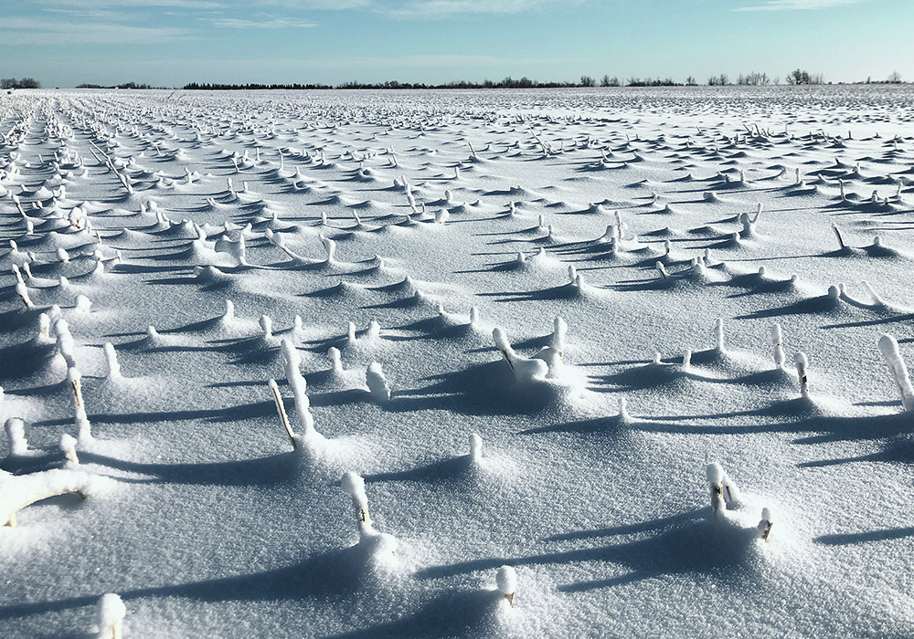
Most people on the Prairies would probably agree that winter doesn’t really arrive until there is snow on the ground, or snow has fallen and temperatures are cold enough that it doesn’t really melt. For this discussion, I will use that as our measure.
Looking at previous years’ snowfall events, I found that large single-day snowfalls are rare. When I looked at the number of times Winnipeg, Brandon and Dauphin received more than 10 centimetres of snow in one day over the last 70 years, I was surprised to find that on average, this occurred a little less than twice per winter in all three locations.
When we bump up the single-day snowfall to 15 cm or more, this occurs a little less than once per winter, on average. If we increase the single-day snowfall to 20 cm or more, the frequency drops to around once every five years.
Finally, to show the rarity of really big snowstorms in our region, the probability of receiving 30 cm or more in one day is once every 30 or so years. Remember, this is a one-day event. Often, we see snow fall over two days.
From December to February, agricultural Manitoba on average receives about 50 cm of snow, so all it takes is one big storm and we’ll be at average or even above-average for the winter. This is why it’s so hard to predict whether winters will be wet or dry; often it only takes one storm to make a wet winter.
When will cold temperatures move in, and how cold will the winter be? While we can get cold temperatures without snow covering the ground, we do need snow cover to get extremely cold and sustained cold temperatures.
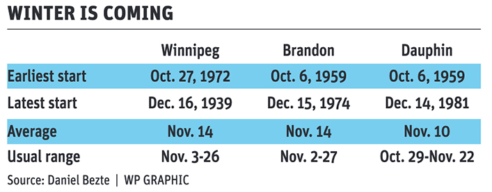
Snow cover insulates the ground, trapping heat and preventing it from warming the air above it. Snow also has a very high albedo. It reflects a large proportion of the sun’s energy.
Finally, snow is cold. We really notice this in spring, but having snow on the ground at any time of year acts like a refrigerator to keep temperatures down.
How cold will this winter be? Luckily, temperature forecasts over the winter are often a bit easier to figure out. That doesn’t mean they are super accurate.
If we look at the different large-scale features heading into winter, it looks like an El Niño winter. El Niño winters over the last 50 or so years were milder than average 60 percent of the time. They were near average 20 percent of the time and below average by that same percentage.
If we were to go with the pure statistics, there is an 80 percent chance this winter will see near to above-average temperatures.
Daniel Bezte is a teacher by profession with a BA in geography, specializing in climatology, from the University of Winnipeg. He operates a computerized weather station near Birds Hill Park, Man. Contact him at dmgbezte@gmail.com.


