


Glacier FarmMedia – Not only did December fly by, but it seemed like the entirety of 2024 did too.
Let’s start the year with our usual look back at the month that was, and then we’ll peer into the future to see what the weather may hold for us for the latter half of the winter.
Overall, it was a warmer and drier than average December across the Prairies. While there were a couple of short cold snaps, warmer than average conditions prevailed for most of the month.
Read Also
Herbicide resistance sprouts in Manitoba’s wild oats
Farmers across Manitoba this fall are gearing up for the latest salvo in what, for many, has become a longtime battle to beat out wild oats.
Calgary was the warm spot in December, both for actual temperature and difference from average. Edmonton edged out Winnipeg for the next warmest actual temperature, but Winnipeg edged out Edmonton when temperatures are compared to average. There was a fairly significant difference in actual temperature across southern Manitoba with western regions reporting temperatures as much as three degrees Celsius colder. This was largely due to persistent cloud cover over eastern regions helping to keep temperatures up. The cold spot in December for actual temperature was in Brandon, while compared to average, Regina ended up as the coldest location.
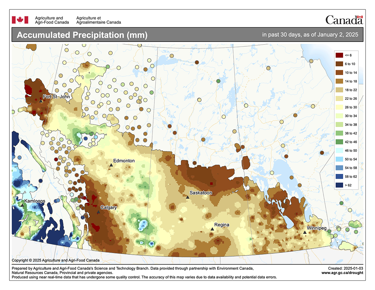
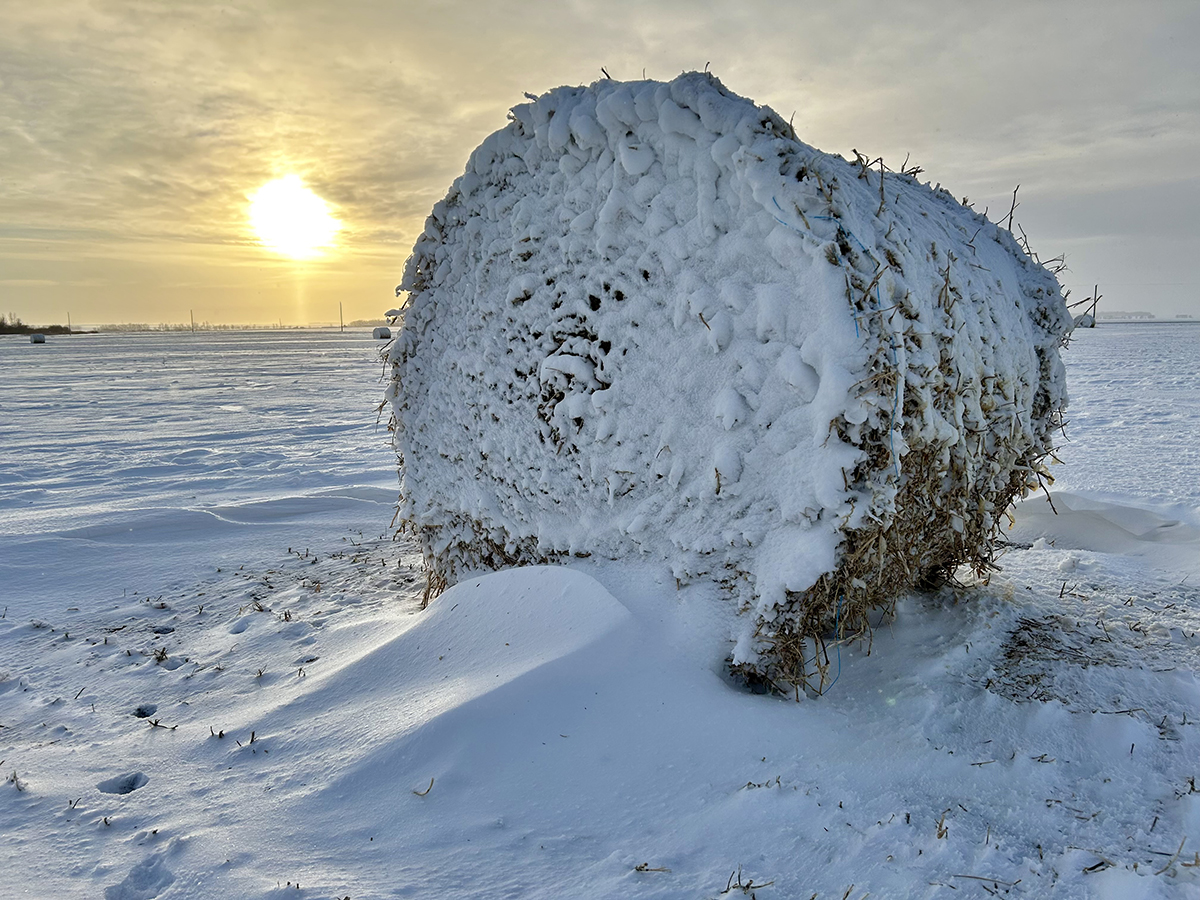
With one exception, December precipitation totals across the Prairies were either near or below average. The one exception was Brandon, which saw more than double the long-term average. A couple of heavy snow events impacted the Brandon region with one event alone dropping nearly 22 centimetres of snow. Dauphin, Edmonton, and Saskatoon all came in near to slightly above-average in December, with Regina,Winnipeg, and Calgary coming in just a little below-average. The dry spot was Peace River, which only saw 4.4 millimetres of water equivalent precipitation, which was 13 mm below the long-term-average.
Looking back at the different weather predictions for the month, I would have to give the win to the CFS model with the prediction of warmer-than-average temperatures with near-average precipitation over southern regions and above-average over more northern regions. While the more northern region’s part did not really pan out, I still give them the win over the second-place prediction which was my own. I called for near- to slightly above-average temperatures with near-average snowfall.
Now on to our latest and greatest predictions for what will hopefully be the last three months of this winter. The Old Farmer’s Almanac is predicting the next three months to be colder and snowier than average, with January and February being well-below average and February being the snowiest month. The Canadian Farmers Almanac, after reading through each month’s description of their predicted weather events, seems to be calling for a colder-than-average January with near-average precipitation. While they mention cold weather several times, they point out above freezing temperatures at the end of the month. February sounds like it could be a stormy month as they note a large snowstorm early in the month and then some more stormy weather later in the month. They only mention cold weather once so I will go with near-average temperatures. March sounds like it could be a bit of mixed bag as they call for fair weather, stormy weather, and some cold weather. Overall, I call it near-average for both temperatures and precipitation.
Next up are the different weather models. NOAA’s three month prediction, extrapolating northwards the best I can, appears to be calling for similar conditions – cold and snowy. According to NOAA, the best chance for below-average temperatures and above-average precipitation will be over the western Prairies, with eastern regions seeing the best chance of near-average temperatures and precipitation. Next is last month’s winner and the weather model that usually does the best job, the CFS model. It says January will see below-average temperatures with near-average precipitation. This will be followed by a colder-than-average February and March along with above-average precipitation, and much like the other predictions, western regions see the best chance of both the coldest temperatures and heaviest precipitation.
Looking at the Canadian CanSIPS model, its latest prediction is for a colder-than-average January over the eastern Prairies with above-average temperatures over western regions. This then transitions into colder-than-average temperatures right across the Prairies in both February and March, with the coldest temperatures predicted to be over the eastern half of the region. While this model is like the others regarding temperatures, the precipitation prediction is for near-average amounts in all three months.
Last on our list of weather model predictions is the European ECMWF. This model is a little more optimistic in its temperature prediction, calling for near-average temperatures over the next three months. ECMWF’s precipitation prediction is for above average amounts in January followed by near average amounts in both February and March.
Overall, it looks like most long-range weather predictions of the rest of the winter are leaning towards a cold and snowy conditions. My gut is leaning towards the European model, but I am going to tweak the February and March temperatures to near to slightly below-average. Here is hoping that however the weather turns out, you get at least a little bit of the type of weather you want.
Daniel Bezte is a teacher by profession with a BA in geography, specializing in climatology, from the University of Winnipeg. He operates a computerized weather station near Birds Hill Park, Man. Contact him at dmgbezte@gmail.com.


