Here’s a couple of useful weather apps to consider.
The first one is Zoom Earth. It is free and can be installed as an app or seen on their website. It gives worldwide satellite imagery and you can easily zoom in and out. It will also show the track of tropical storms.
Along with satellite imagery, you can overlay radar, precipitation forecasts, wind speed forecasts and temperature, humidity and dewpoint forecasts, and it will also show the forecasted atmospheric pressure. The only drawback, at least for me, it that the forecasts only go out about 48 hours.
Read Also

Canadian Food Inspection Agency extends chronic wasting disease control program consultation deadline
Date extended for consultation period of changes to CWD program
The second app is called Radar Scope and it does have a cost. It provides radar imagery showing typical precipitation depiction by any radar site or app. You can also play around with several other depictions, like velocity and differential reflectivity.
As with Zoom Earth, you can quickly and easily zoom in and out, but you have to change radar stations if you want to move around the country. The Pro Tier One subscription costs about $12 for the year. This is my go-to app when I want good detail on any precipitation event, especially thunderstorms.
Now to our look at September weather across the Prairies. Alberta saw slightly above-average temperatures along with below-average precipitation. Temperatures ranged from around 3 C warmer than average in the south to about 2 C warmer than average over central and northern regions.
The hot spot was Calgary, with a mean monthly temperature around 14 C. Precipitation was light with most regions seeing 10 to 15 millimetres and far northern regions seeing less than 10 mm.
In Saskatchewan, warm above-average temperatures continued. Saskatoon recorded a mean monthly temperature of about 15.5 C, 4 C warmer than average, and Regina was a little warmer at 15.8 C, also about 4 C above average. Precipitation was well below average at five to 10 mm in most locations.
Above average temperatures continued into Manitoba. In fact, Winnipeg was the warmest location of our main reporting centres across the Prairies with a mean monthly temperature of about 16.3 C. The Brandon and Dauphin regions both reported mean temperatures of about 15 C. These readings were 2 to 3 C above the long-term average for the month.
Manitoba also saw a dry September. The Dauphin region was driest with 15 mm of rain, while both the Brandon and Winnipeg regions saw 30 to 40 mm.
Now to the latest long-range weather outlooks, starting with the almanacs, which, by the way, did not do a very good job with September’s forecast.
The Old Farmer’s Almanac calls for above-average temperatures in October along with below-average precipitation. November and December are forecast to see below-average temperatures and above-average precipitation.
The Canadian Farmers’ Almanac predicts a colder and wetter than average October. It predicts November will be colder and wetter than average. Its December forecast calls for near-average temperatures and above-average precipitation.
As for the weather models, NOAA predicts near-average temperatures with near- to below-average precipitation. The CFS’s latest three-month forecast calls for above-average temperatures with near-average precipitation. The CanSIPS model is also calling for above-average temperatures and near-average precipitation.
Finally, the ECMWF (European model) is calling for near- to slightly above-average temperatures along with near-average precipitation.
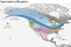
Last on the list is my attempt. With El Niño firmly in place, I will play the odds and go with above-average temperatures and below-average precipitation to end 2023.
Daniel Bezte is a teacher by profession with a BA in geography, specializing in climatology, from the University of Winnipeg. He operates a computerized weather station near Birds Hill Park, Man. Contact him at dmgbezte@gmail.com.