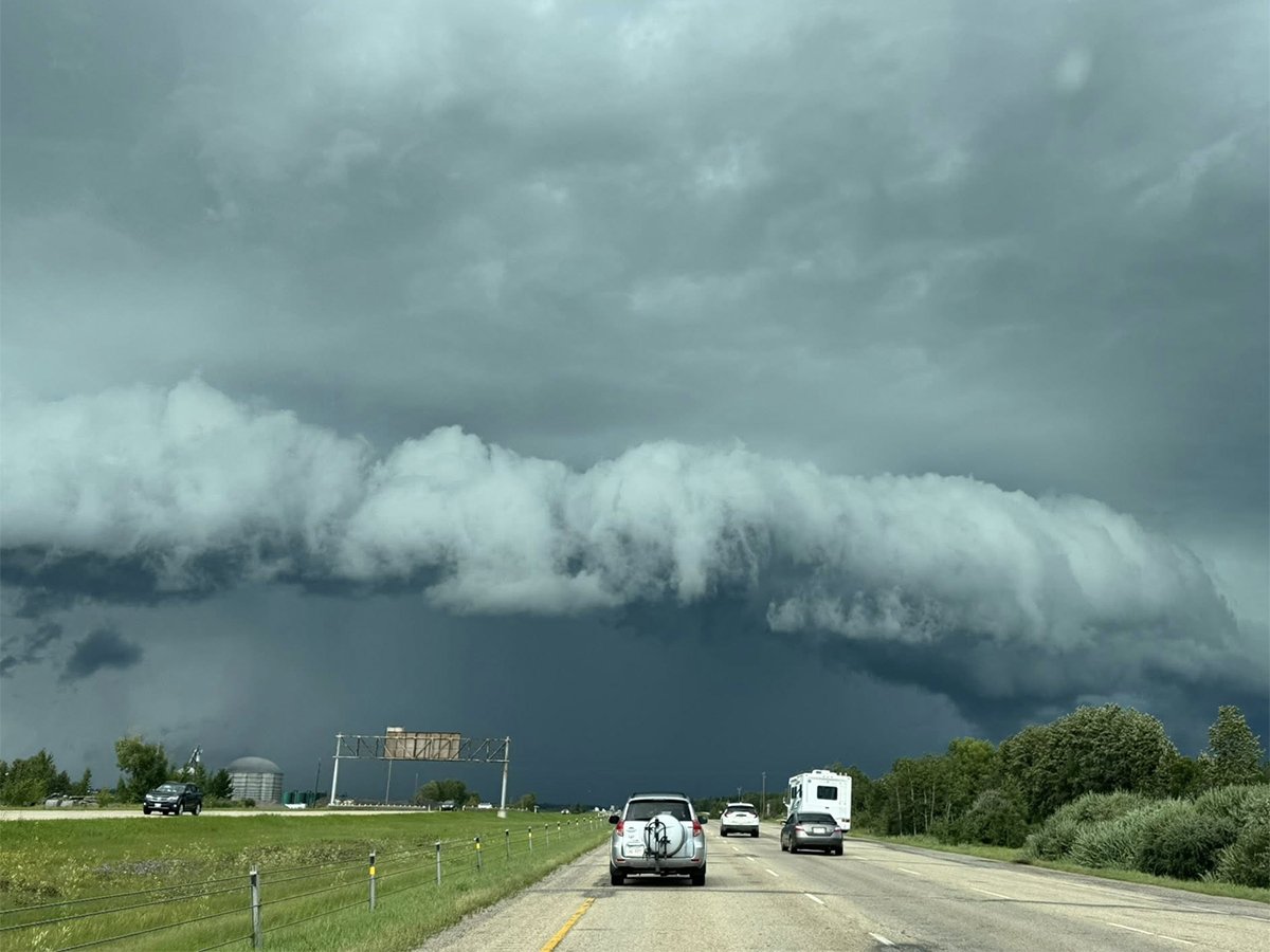
Looking at July’s temperatures, it was a cooler than average month right across the Prairies, with most places coming in just slightly below average.
Overall, the warmest regions were southern Manitoba and southern Saskatchewan. The cold spots in July were Edmonton and Calgary, thanks partly to the wet conditions those regions experienced during the month.
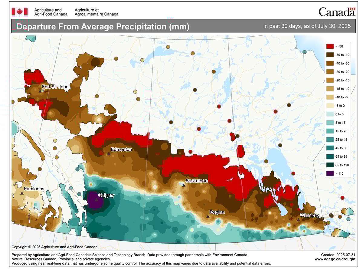
Looking at July’s precipitation, it was once again a dry month right across the Prairies with a couple of exceptions — Calgary, Saskatoon and Edmonton.
Read Also
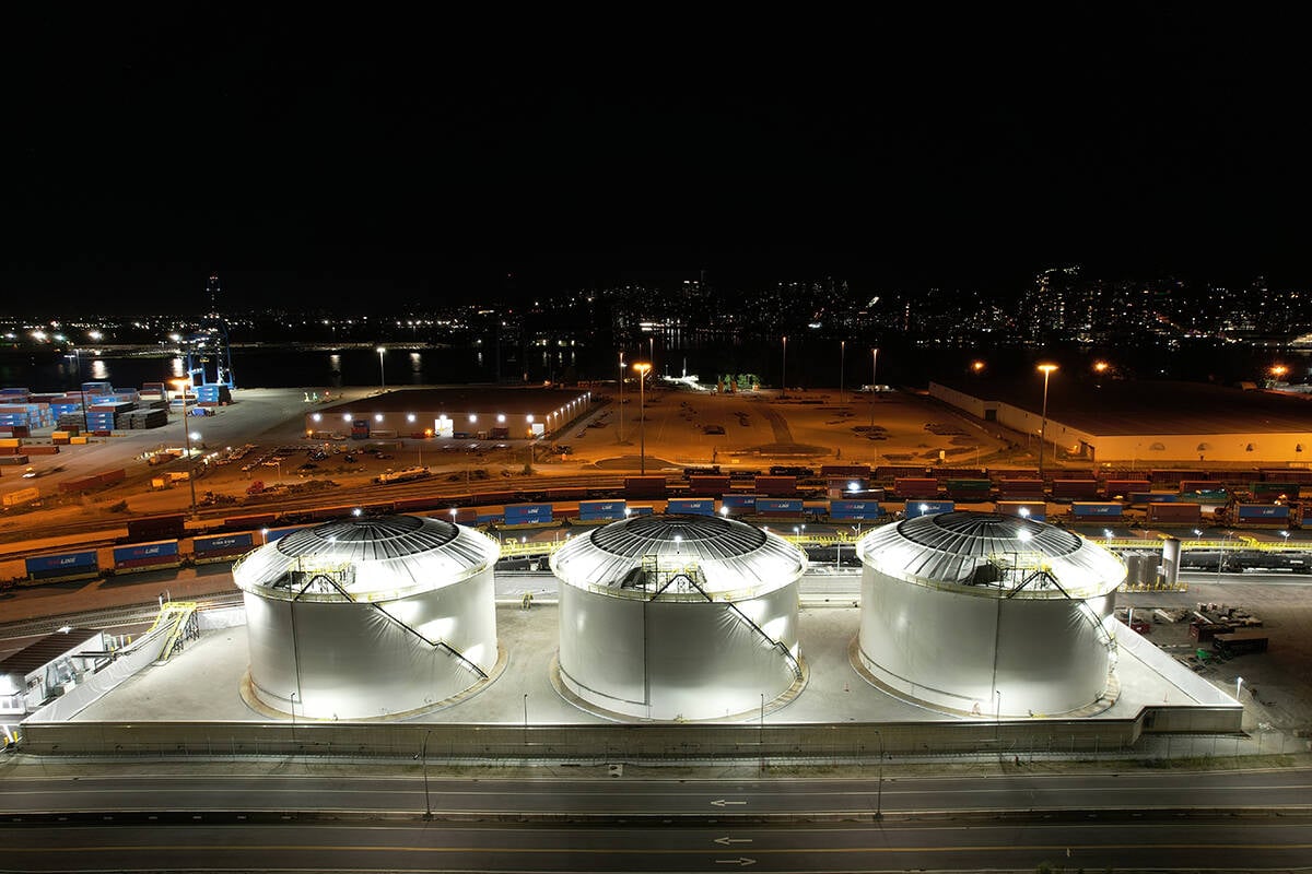
Canola oil transloading facility opens
DP World just opened its new canola oil transload facility at the Port of Vancouver. It can ship one million tonnes of the commodity per year.
These three locations all reported above average amounts with Calgary recording almost three times its average. Elsewhere, it remained dry, with all the other reporting stations coming in with less than 40 millimetres of rainfall in the month.
Overall, it was a cooler than average July, with southern Alberta through to extreme southern Manitoba seeing above average rainfall while the remainder of the Prairies continuing to be dry.
Now on to our look at the latest extended forecasts.
The Old Farmer’s Almanac is calling for below average temperatures in August followed by near to slightly above average temperatures in September and October. Along with the colder than average August, it is calling for above average precipitation, with September and October seeing near average amounts.
The Canadian Farmers Almanac appears to be calling for near average temperatures in August along with near to above average rainfall. Both September and October look cooler and wetter than average.
Moving on to the weather models, NOAA’s forecast looks to be calling for slightly above average temperatures right across the Prairies from August through to October, with precipitation coming in near to slightly below average.
The CFS model is currently calling for above average temperatures right across the Prairies for all three months.
Its precipitation forecast is calling for above average amounts across southern Manitoba and Alberta along with northwestern Alberta in August, with the rest of the Prairies seeing near average amounts.
September’s forecast is for near average amounts across most regions with east-central Saskatchewan and west-central Manitoba seeing above average amounts.
October’s precipitation forecast is for near average amounts with a chance of slightly above average amounts over western Alberta and central Manitoba.
The CanSIPS model is calling for below average temperatures across the southern Prairies with above average temperatures over northern regions in August.
Alberta is expected to see above average rainfall along with parts of central Saskatchewan and northern Manitoba.
Above average temperatures return to all parts of the Prairies in September and October along with near average precipitation.
The European (ECMWF) model is calling for warmer than average temperatures for August, September and October, with August seeing well below average rainfall, transitioning to near average in September and near to slightly above average in October.
Personally, I am leaning toward the CanSIPS model.
In our next issue, we will continue our look into severe summer weather by finishing up our look at heat waves.