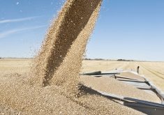
The Manitoba government says there is a potential for rivers across southern Manitoba to flood farmland this spring, especially in the western part of the province.
Heavy rain in the fall and heavy snow this winter make flooding likely along the Assiniboine River, according to Manitoba Conservation.
Here is the forecast for other rivers, assuming normal precipitation.
Souris River: Probable agricultural flooding with peaks similar to 1999 levels; 10 percent chance that high snow and rain could make peak levels just .6 metres lower than the record 1976 flood in the Coulter-Napinka area. Tributaries will also likely flood, especially those rising in Saskatchewan like the Antler River, and Gainsborough and Pipestone creeks.
Red River: Probable agricultural flooding similar to levels in 1999; 10 percent chance that high snow and rain could see levels reach 1996 levels, when farmland flooded extensively but homes weren’t threatened.
East of the Red River: Low-lying areas will likely flood along the Roseau, Rat, Seine, Brokenhead and Whitemouth rivers, and Cooks Creek.
Westlake: Turtle, Big Grass and Whitemud rivers could have minor flooding.