LINDALL BEACH, B.C. – A controversial dam proposal on the Peace River, which would flood about 13,000 acres of land, is moving to the next phase.
The British Columbia government announced it will conduct a regulatory review of its Site C Energy Project, a $6.6 billion plan to build a third dam and hydroelectric generating station on the river in northeastern B.C.
If it goes ahead, the dam would come on line in 2020, when it will be expected to produce enough electricity to power about 410,000 homes annually.
Read Also

Fuel rebate rule change will affect taxes and AgriStability
The federal government recently announced updates to the fuel rebates that farmers have been receiving since 2019-20.
The review, stage 3 in the five stage plan, includes independent federal and provincial environmental ass-essment processes expected to take two years.
The proposed dam will be about 1,100 metres long, and 60 metres high above the river bed, creating a reservoir that will be about 83 kilo-metres long and, on average, two to three times the width of the current river.
The decision to advance the project was made at a time when BC Hydro, the province’s power utility, said its electricity needs will grow by 20 to 40 percent over the next 20 years.
“Hydroelectric power helped develop our province and Site C will build on B.C.’s heritage of clean, renewable and affordable power,” said premier Gordon Campbell in a news release. Damming the Peace River has been controversial from the beginning. In 1968, the W.A.C. Bennett Dam came on line amid bitter debate.
The Peace Canyon Dam was completed in 1980 and Site C has been on BC Hydro’s radar since.
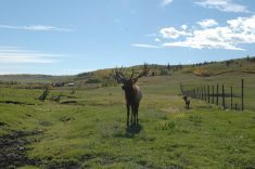
In addition to diverse wildlife and plant species, the Peace River Valley supports rare species and is a major corridor for wildlife.
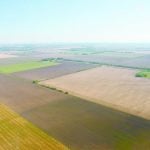
According to a new study titled BC’s Peace River Valley and Climate Change, the valley contains a substantial amount of exceptional agricultural land due to its unique warmer microclimate and longer daylight hours during the growing season.
The West Moberly First Nations and the Peace Valley Environmental Association produced the study with funding from the Vancouver Foundation, a charitable organization that provides grants for community projects.
About 10 percent of the land in the valley is classified as Class 1 agricultural and accounts for most of Class 1 land in northern B.C.
The Peace River is about 1,900 kilometres long from the Rocky Mountains in northern B.C. through northern Alberta.
In addition, about 50 percent of land in the valley is classified as Class 2, which, with irrigation, would upgrade to Class 1.
According to Asa Feinstein, the study’s author, “at least 60 percent of the land that would be flooded by Site C’s reservoir has an agricultural capability class rate of 1 and 2 and at least 74 percent has a rating of 1 to 3.”
She noted that virtually all the land is within the Agricultural Land Reserve, a protected area, and the loss would place constraints on the region’s agricultural industry and threaten the economic viability of some agricultural production at a time when the desire for locally grown food and the need for food security has risen.
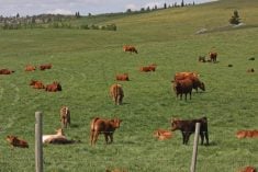
“The dam will flood some of our land,” said Irene Ardill of Ardill’s Ranch in the Fort St. John area.
“No one really knows what the total effect will be. Gordon Campbell gave the impression that they will do this tomorrow but they are misleading people. It’s the environmental assessment stage that is the make or break stage. They have to do a proper study.”
Arlene Boon agrees. She and her husband, Ken, produce forage crops on their 1,300 acres.
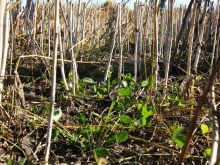
Site C threatens to flood their farm and destroy the fields that produce alfalfa/grass hay.
They plan to dedicate 20 acres this summer to a bale-a-thon to raise funds for the Peace Valley Environment Association to fight the dam.
Critics also contend that the project will be a heavy emitter of greenhouse gases and not the clean source the government says it will be.
According to BC’s Peace River Valley and Climate Change study, once the forests in the valley are flooded, their decay will release methane, which is 25 times more potent as a greenhouse gas than carbon dioxide. This could continue for decades, said the study.
There is also the loss of forest and wetlands that now help ease climate change by storing carbon.


