OLDS, Alta. – When it was time to renovate the Olds College feedlot, beef instructor Neil French wanted it built with precision.
Enter the college engineers, who put together plans using aerial photography, computer graphics and global positioning systems.
“The technology has been here for four or five years but it just isn’t used that much,” said French.
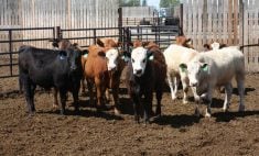
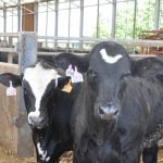
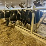
The result is a 600-head lot holding college and custom-owned cattle in pens with perfectly placed fence lines and scientifically designed drainage into a new settling pond.
Read Also
Charges laid after cattle theft
Saskatchewan RCMP lay two charges against a man after six cattle went missing.
What makes this feedlot unique is that all the preliminary plans were calculated on a computer before any manual labour started.
“There was no tape measure anywhere,” said French.
Agriculture engineer instructor Murray Taylor was able to plan the alleys and decide which way gates should swing to move cattle efficiently. He used a program called AutoCAD superimposed over air photos and satellite pictures of the college site.
“From a planning perspective, you could run a virtual cow through this corral,” he said.
The lot was expanded to seven pens from four. It would have expanded more but the aerial photographs revealed a main underground water pipeline supplying three nearby towns crossed beneath college property. The line was discovered when the photo showed an indentation on the land.
Plans were realigned and using global positioning co-ordinates, measurements were calculated for postholes, exact pen size and the amount of fencing required in the new yard.
When it was time to set in the new posts, the person measuring the lot carried a handheld GPS unit that provided the co-ordinates for fence placement based on the design derived from the aerial photos.
An X was marked on the ground with spray paint and the builders were able to sink the new postholes without repeated measurement and estimates of where they should be placed.
It took about two hours to plot the new yard versus the several days that it might have taken under traditional measures.
The college sees wider applications for the intensive livestock industry or other major property developments.
Air photos of the property along with computer graphics can be presented to approval boards to show exact building location, drainage patterns and precise distance from neighbours.
“The county has a great deal more assurance from looking at a drawing or an air photo rather than little napkin sketches. There is built-in credibility,” said GPS instructor Gordon Gilchrist.
Aerial photos are available from government and private websites for a fee. The exact description of the land location is required to download images. Original farm survey plans are also on-line, as well as maps showing utility rights of way, pipelines and drainage systems.
At the college, students learn to read aerial photographs to calculate land area and topography and plan new projects. These can be used for agriculture, forestry, parks or the oil and gas industry. They are especially valuable for before and after shots of oilfields so farmers have a land inventory and proper mitigation can be planned after the company leaves.
“It’s just so much easier. Seeing is believing,” said Gilchrist.
“They can get a feel for the lay of the land. With a picture they can see immediately what is there before they go out on the land.”
Planners can count trees and find swamps, depressions or hills that could present obstacles to planning.
The maps are also useful for laying out rotational grazing plans, especially on odd shaped pieces of land.
This system does not help settle property line disputes because it is not a legal survey.
“It tells you whether or not you should spend the $900 to get it surveyed,” said Gilchrist.