Fjords rank among nature’s most impressive landscapes.
Formed by glaciers, these deep, narrow inlets from the sea extend far inland and are often lined by steep cliffs.
Mention fjords (a word with Norse origins) and places like Norway or Greenland spring to mind. However, this summer we were surprised to find that one of the world’s larger fjords is not only in Canada but is also easily accessible as part of a scenic road trip.
Read Also

Accurate accounting, inventory records are important
Maintaining detailed accounting and inventory records is not just a best practice; it’s a critical component of financial health, operational efficiency and compliance with programs like AgriStability.
The Saguenay Fjord is less than a three-hour drive north of Quebec City. From its mouth on the north shore of the St. Lawrence River, the fjord extends inland for more than 100 kilometres to the city of Chicoutimi, where the Saguenay River flows into the fjord.
In places, the cliffs rise more than 400 metres, and the depth of the water averages more than 200 metres. The navigable fjord is a popular destination for cruise ships.
The most southerly fjord in North America, it’s unusual for being inhabited, unlike most others in remote settings. Roads run along both sides.
There are two main ways to cross the fjord — over a bridge at Chicoutimi or the free ferry service across the 1.3-km span along the mouth of the fjord. Signs along the way indicate the Fjord Route, guiding tourists to the main points of interest.
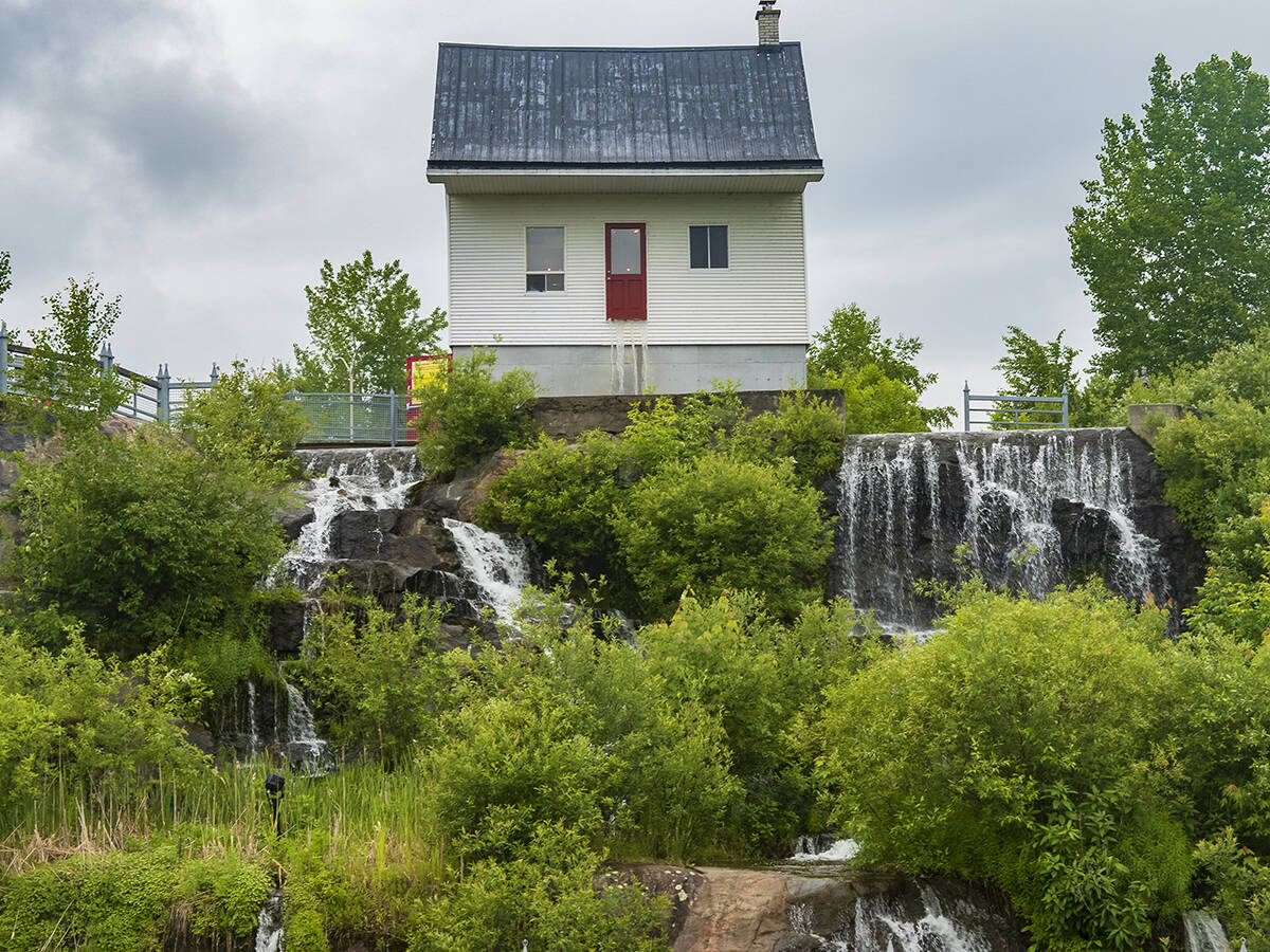
Chicoutimi and its surrounding communities provide most visitor services and attractions such as museums, including the unusual Little White House Museum.
It harkens back to 1996 when the city experienced a disastrous flood caused by heavy rain. The dam eventually burst, destroying 800 homes and taking 10 lives.
Though almost 30 years ago, we remember seeing coverage on the national news. What stood out was that in an area where every building was completely washed away, one little white house defied the odds and remained standing in the deluge.
Now restored as a museum, it tells that fascinating story. Even today, it is surrounded by water.
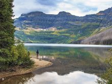
Most of the mountainous fjord is preserved in parks. Scenic viewpoints abound, with more hiking trails than you can shake a walking stick at.
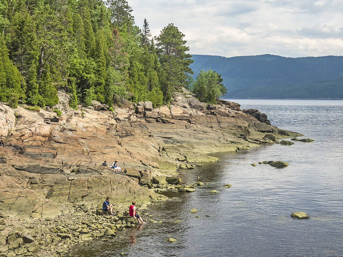
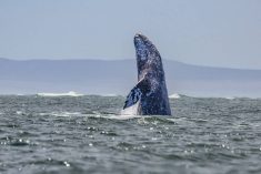
Protection extends beyond the land. The waters are part of the Saguenay-St. Lawrence Marine Park, known for its rich marine ecosystem caused in part by a mix of seawater and fresh water from rivers flowing into the fjord.
Seals and minke and beluga whales frequent the area, and the mouth of the fjord near the town of Tadoussac has a reputation as one of the top whale watching spots in Canada.
Outside the Chicoutimi area, the communities around the fjord are small and almost always in picture-perfect settings.
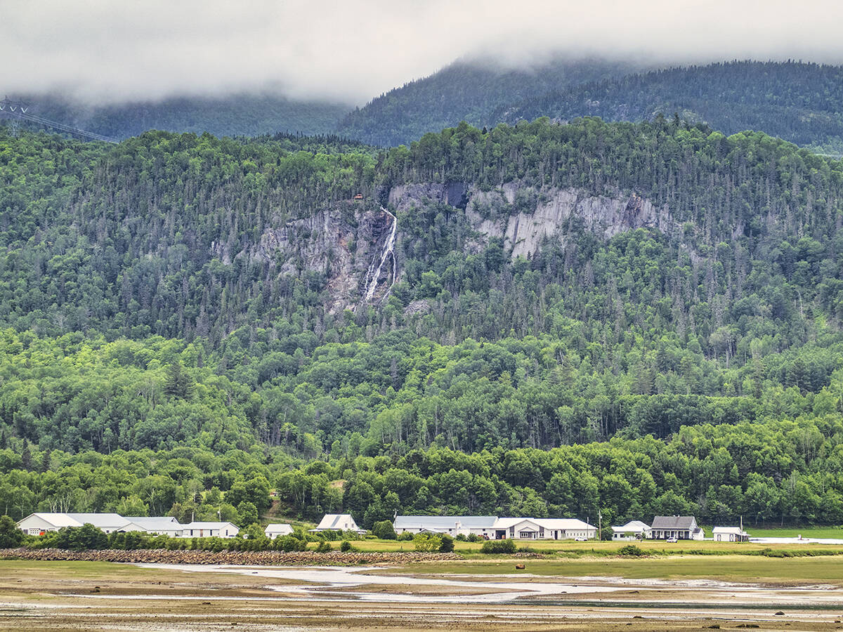
We especially enjoyed tiny Petit-Saguenay, its waterfront in a dramatic setting overlooking soaring cliffs with a plunging waterfall. The access road along a river valley was lined with wildflowers and had beautifully situated picnic sites.
Quebec excels in having plenty of rest stops and picnic stops along highways and in most communities.
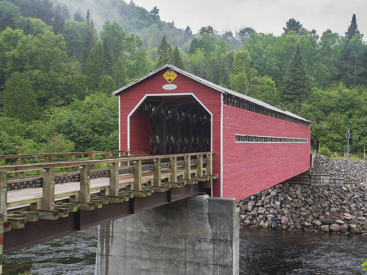
Another scenic village is L’Anse-Saint-Jean, where you can drive over an historic covered bridge and take a short walk to a viewpoint with a thousand-dollar view — literally. This scene over the cove on the edge of the village was used on the Canadian $1,000 bill.
The trees are taller now, obscuring part of the covered bridge, and a few more houses have been added, but the scene still looks much the same.
Sainte-Rose-du-Nord, on the north side of the fjord, was named among the most beautiful villages in Quebec. We descend a winding road past an agricultural valley to the community sandwiched between the mountains and the beach, with cliff-lined shorelines just beyond.
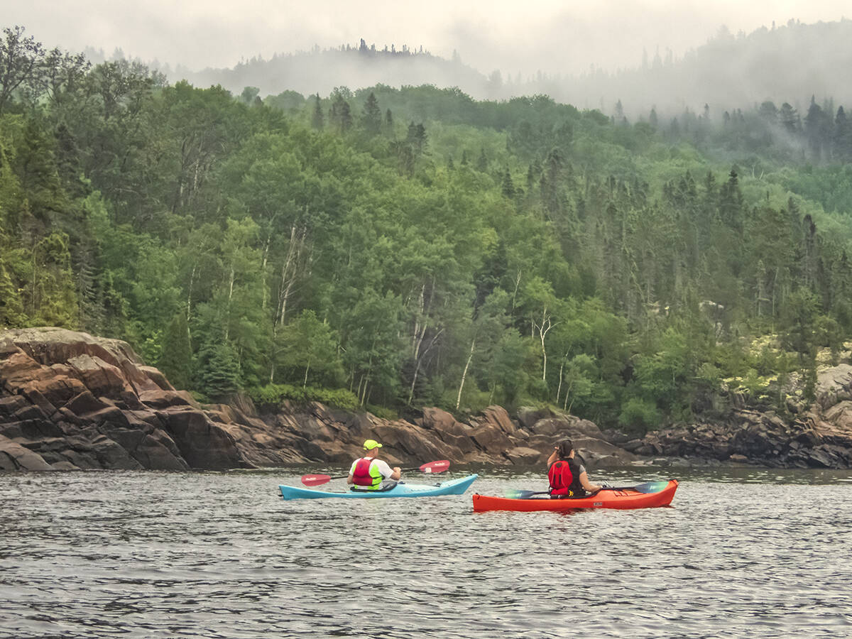
After spending the night in Sainte-Rose-du-Nord, we woke up to rain and fog on July 1, Canada Day. Despite the weather, the village still had a Canada Day procession with people dressed mostly in red and white, waving Maple Leaf flags and singing O Canada.
We had planned a kayaking excursion that morning and decided to go ahead in the rain. It was reasonably warm, and the water remarkably calm.
Fog and low clouds hanging over the cliffs added to the mystical feeling. It turned out to be a great ending to our wanderings around Canada’s most accessible fjord.