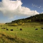
Winnipeg (MarketsFarm) – Manitoba’s Red River Valley is very wet heading into the winter freeze, but it’s still too early to say if the saturated soils will lead to flooding in the spring, according to provincial forecasters.
The Manitoba government took the unprecedented step of opening the Red River Floodway on Oct. 9, marking the first time the channel that helps manage river levels in Winnipeg was ever operated in the fall.
Winnipeg received 153 millimeters of rain in September, and a system that hit the city on Thursday and Friday was expected to bring an additional 60 to 100 millimeters of moisture (in the form of rain and snow) to southern Manitoba over the next few days, according to Environment Canada forecasts.
Read Also
Expana lifts EU cereal forecasts, maize exceeds expectations
Expana has raised its monthly grain production forecast for European Union crops for the 2025/26 season, projecting soft wheat output will hit a record high and barley a 17-year high.
Agroclimate maps compiled by Agriculture and Agri-Food Canada show that southern Manitoba received more than 200 per cent of its average precipitation over the past month. Soil moisture maps for the United States also show wetter-than-normal conditions across North Dakota, which feeds into the Red River.
While the wet fall weather contributes to the possibility of a spring flood, “fall conditions are one of many factors,” said a provincial government communications official noting that multiple elements go into a flood forecast.
Passing on information provided by the provincial Hydrological Forecast Centre, the government official noted that the amount of precipitation over the winter, rate of melt, and depth of frost will also be major factors in whether or not there is a spring flood.