FORT MACLEOD, Alta. – A grizzly bear sighting is a sure sign of a healthy ecosystem.
But a consultant studying the effects of human development in southwestern Alberta says the big bruin is in jeopardy in the region as more roads, more energy exploration and more residential development destroy not only the bear’s habitat but also the reasons why many people want to live there.
The Chief Mountain cumulative effects study takes a bird’s-eye view of land and water use on 2.2 million acres in Waterton Lakes National Park, the Municipal District of Pincher Creek, Cardston County and the Blood and Peigan First Nations.
Read Also

U.S. farm group supports supply management
U.S. grassroots farm advocacy group pushing new agriculture legislation that would move towards supply management like Canada has for dairy industry
Similar to a study conducted in the foothills region last year, this new report predicts major change for the region.
“We will not see wild change in the landscape types but there is one significant change and that is doubling population,” Barry Wilson of Silvatech Consulting based in Salmon Arm, B.C., said at a recent meeting of the Oldman Water Council in Fort Macleod.
“If we double the population, the assumption is that acreages surpass agricultural residences by 2040 and then they start to skyrocket,” he said.
“Anyone who lives south of Calgary would say that is not unrealistic.”
Wilson recommends that his study and the foothills study be included in the provincial land use framework that is looking at future uses and effects on land, water and air.
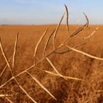
In the region that Wilson studied, close to 45 percent of the land is cultivated, 28 percent is grassland, 18 percent is forest and the rest is under other uses.
The study found that an increasing population threatens grasslands. As the native grasses are removed, more invasive plants will appear.
Native grasslands shrank by 20,000 acres in the last 50 years. About 475 acres of native grass are converted to tame pasture each year but more loss is attributed to invasive plant species with a 50 percent increase in 50 years.
“That would equate to about 500 acres per year of native landscape types being converted to tame grass,” Wilson said.
Less surface and ground water will be available in the next 50 years. Shallow ground water levels are dropping and heavy consumption of surface water is exceeding nature’s ability to recharge ground water.
Water demand in the area has increased 3,600 percent since 1900. According to Alberta Environment, 0.01 percent of Alberta’s ground water is recoverable and usable. More wells will be drilled for household and livestock use, which will also draw down aquifers.
While the government has placed a moratorium on new water licences in the South Saskatchewan River basin, water is available under unused current licences.
However, water quality is another issue. Surface water quality is showing five times more nutrient levels since settlement. Wilson said this will continue to be a problem partly because of the degradation of native grasslands and forests. When forests and grasslands are lost to fire, insects or harvesting, water availability and quality are affected because plant systems act like a sponge to hold and filter water.
About 90,000 cubic metres of softwood including salvage and 36,000 cubic metres of hardwood are removed from the area each year.
More transportation networks are responsible for half the ecological footprint left in the area, including public roads and residential driveways.
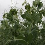
The study authors do not see much more agricultural development in the area. Five crops are grown in the area but cereal production could drop as more land is taken up for residential development.
About 85 percent of livestock consists of cattle on the range and in feedlots.
Wind energy development is prominent in this region. There are 251 wind turbines, which is expected to increase to 1,000 in 50 years. However, they will use only 200 acres of land.
The greater issue is the visual impact on the landscape when large groupings of turbines are built on a hill crest.
Hydrocarbon activity should peak in about 20 years time, including conventional oil and gas work as well as coalbed methane activity.
In the last 25 years, 500 kilometres of pipeline have been laid.