Heavy thunderstorms, which sent tornadoes whirling through southern Manitoba June 23 and 24, and off-and-on rain last week have filled a number of rivers in the province almost to the bursting point.
Some of the worst flooding last week was happening in the eastern parts of the province near Whiteshell Provincial Park, with campgrounds and roads washed out, said Alf Warkentin, provincial flood forecaster.
Heavy rainfall June 25 soaked a strip stretching from Morden to Ste. Anne, and dumped a load across the U.S. border on parts of North Dakota and Minnesota.
Read Also

Agritechnica Day 3: Hybrid drive for a combine, data standards keep up to tech change and tractors of the year
Agritechnica 2025 Day 3: Hybrid drive for a combine, data standards keep up to tech change and tractors of the year.
The Pembina River, from Lena to Snowflake near the border, had flooding after the area got 100 millimetres of rain two weekends ago. The Assiniboine River had also been running high, but water is being drained off at the Portage diversion channel, which carries excess water into Lake Manitoba.
Farther upstream, at Lake of the Prairies, water is still two-thirds of a metre over the spillway.
“The Red River is still on the rise. We’re probably going to see the crest by the end of the week,” he said. “The floodway is not in use yet, but some water is flowing naturally into it.”
On June 27, the Red River level was 4.5 metres, with the peak flow expected to hit five metres, which is three metres over normal summer levels. The river was expected to rise to almost five metres in downtown Winnipeg by June 28 and remain near that level until July 4. Anything over 5.4 metres could result in widespread flooding in the city.
“We’re not going to get to that level. But the danger is that if there is a severe thunderstorm over the city with these kinds of levels, we could get sewers backing up,” Warkentin said. “That could cause a lot of damage.”
The Portage diversion was put into operation June 26 to reduce rising flows on the Assiniboine River. That was aimed at reducing the crest in downtown Winnipeg by about a third of a metre and prevent levels from exceeding 4.8 metres.
The Pembina River and most Manitoba tributaries of the Red River from Grand Forks northward rose sharply June 27. Total anticipated rises ranged from a metre from Emerson to the floodway inlet and about 0.6 metre from Lockport to Selkirk. Localized overland flooding was underway and some small streams may reach full capacity. Flooding is not expected along the main stem of the Pembina River and no problems are anticipated in the Gretna area.
Flooding of some low lying agricultural lands was expected from Letellier to St. Jean Baptiste, but elsewhere the river will remain within its banks.
Although peak stages will still be one to 1.5 metres lower than those of the record summer flood of 2005, last week’s deluge has been one of the largest summer events for the Red River, according to a flood advisory issued by the provincial government.
Stan Cochrane of the Assiniboine Valley Producer’s Association said the risk of flooding in his area has largely passed. A 17 kilometre stretch of the Assiniboine, from the Shellmouth dam to Russell, had seen flooding last month.
“It’s pretty much under control,” he said. “There’s no flooding up by the dam anymore. The river is all back within its banks. It’s all heading towards Winnipeg now.”
Reports said streams in the Dauphin and Duck Mountain regions are still running high. An additional 25 mm of rain has caused some streams in the area to rise again. Localized flooding has been reported by regional government staff.
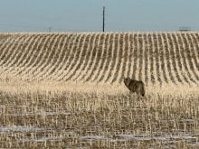
Water levels remain very high in the Saskeram area, northwest of The Pas. While no homes are flooded, there are continued difficulties with cattle due to flooded pastures.
Lake Winnipegosis is presently at its highest level since the mid-1950s. Additional shoreline flooding could occur in low areas if strong winds develop during the next few weeks.