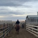
CLARESHOLM, Alta. – The last, best west of the Alberta foothills is feeling the heavy footprints of urbanization, recreation and energy development.
A landowner-sponsored study on one possible future for the southwestern region indicates residents must think hard about how much development they are willing to tolerate.
Supported by landowner groups, municipal governments, as well as two oil and gas companies, the study looks at the area before settlement and what could be expected in 50 years if growth of all sectors continues at the current pace.
Read Also
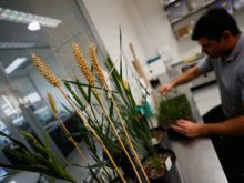
Genetically modified wheat gets closer to reality in U.S.
Argentine company signs deal with Colorado Wheat Research Foundation to commercialize drought tolerant wheat in the U.S.
This study will be followed by written and telephone surveys for a final report to be released early next year.
“It is a unique opportunity for people to have a say on what is going on in their landscape,” said Alan Gardner, executive director of one study sponsor, the Southern Alberta Land Trust Society.
Although natural forces like flood, drought and fire change a community, the human impact has been greatest.
“Landscapes are not static. They have never been the same. They are always changing and they always will,” said Brad Stelfox, a private ecological consultant who led the study.
The study area covers three million acres south of High River to Pincher Creek, west of Highway 2 and east of the British Columbia border.
It is a small geographical region, but it is home to the last remaining large tracts of rough fescue grass, considered an important carbon sink and a sponge for watersheds that drain into rivers flowing across the Prairies.
The study has been presented at seven public meetings in the region, as well as to the Canadian Association of Petroleum Producers and provincial politicians.
No one disagrees with the report’s view, but almost no one has offered a solution to control activity before it gets out of hand, said Stelfox.
He suggested the province could use this region as a pilot project for integrated land planning.
He described the situation as a construction project called Alberta where each sector is building a room without knowing what the final house will look like because there is no plan.
Indications are for more of every kind of development including energy, recreation, cropland, confined feeding operations, acreages and roads, leading to increased fragmentation of the land and water resources.
“All of us recognize in little pieces what has been going on around us,” said rancher Rick Burton.
“Every politician and MLA and senior bureaucrat should get an opportunity to look at that presentation.”
So far, government response has been limited, said Stelfox.
Some residents suggest zoning should be based on carrying capacity of the land.
“We should not fear zoning because we already have it,” said rancher Bill Newton. Development is already controlled through the Agriculture Operations Practices Act, municipal bylaws and subdivision policies.
Significant population growth is forecast. The population could double to 90,000 within 50 years in towns and rural residential parcels.
“Part of the population growth in this general part of the world will be in the larger towns,” Stelfox said.
The study region has about 500 acreages and in 50 years there could be as many as 1,400 country residences, with the most significant growth within commuting distance of Calgary.
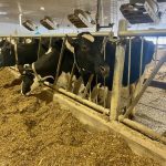
People tend to see this as cowboy country but that is changing. It traditionally supported large cow-calf operations, horses and forage production. The area has 205,000 head of cattle that could increase to 320,000 if feedlots continue expanding.
In 1905, there were 1.69 million acres of rough fescue. Today there are about 522,820 acres of native grasslands left. Most were lost to settlement and invasive species choking them out at the rate of 840 acres per year.
The energy sector leaves the biggest footprint. In total, the province has about 9,000 coalbed methane wells, 130,000 natural gas wells and 90,000 oil wells. This region has 44 conventional wells, 160 gas wells and no coalbed methane, but in 50 years there could be 5,000 wells.
This area also has extensive forests and more logging is expected but Stelfox asked how cut blocks could affect water movement.
Water is a critical factor. Supplies are diminishing while demand increases. A moratorium on further water licences has already been placed on rivers in this basin because the water is fully allocated.
This area sends out about 750 million cubic metres per year through its watersheds and rivers. It uses about 30 million cubic metres.
People also rely heavily on well water, but there are no inventories of aquifer supplies to determine if there is enough to go around.
There are 6,600 water wells in the study area for domestic, livestock and industrial use. The province has about 500,000 wells.
Other major industries affecting the area include tourism, recreation and film making.
The provincial tourism industry is worth $3.5 to $5 billion annually. A large share of that focuses on the southwest where people are looking for a pristine area for hiking, hunting and other minimal-impact activities, while others want a modified landscape for off-road vehicle activities, camping and golf courses.
The film industry pumps in $150 million and 1,200 jobs in the southern Alberta area.