SASKATOON – Scientists are hoping to unlock mysteries of prairie weather in a region known as the Palliser Triangle, by studying soil on lake bottoms.
“It’s a tape recorder of how climate has changed,” said Don Lemmen, research scientist with the Geological Survey of Canada.
In other parts of the world, scientists look at trees or ice caps for keys to weather. But there is a distinct lack of trees and ice caps in the Palliser Triangle.
“We have virtually no data because traditional sources didn’t exist,” said Lemmen of Calgary.
Read Also

Manitoba community projects get support from HyLife
HyLife Fun Days 2025 donated $35,000 each to recreation and housing projects in Killarney, Steinach and Neepawa earlier this fall.
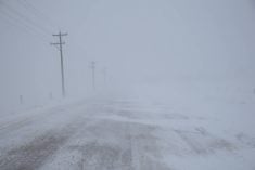
The Palliser Triangle is the driest region of the Canadian prairies stretching from southwestern Manitoba to southwestern Alberta and north to Saskatoon.
It was described by Captain John Palliser in his Canadian exploration during the late 1800s as an area of land almost “uninhabitable” because of its arid conditions.
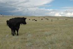
Most prairie lakes are shallow, shrinking in drought years and expanding in years of excess moisture. When the lakes shrink, vegetation around the shores shifts and the chemistry of the lake changes.
By sampling lake bottom sediment, scientists can spot extensive droughts of the past. Samples taken at the beginning of the project revealed there were similar deposits in 1880, 1930 and 1980, all known drought years.
“If you go back a thousand years, you’ll see the same type of deposits, but thicker, meaning there were longer and more severe drought periods,” said Lemmen.
Because recent sediment deposits aren’t as thick, Lemmen believes the past 100 years have been “reasonably mild.”
The scientists are also monitoring shifting sand dunes, taking vegetation surveys and soil samples as keys to the past. They hope to publish maps of historic weather data for regional planners to better manage land use.