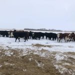
It was a record breaking -38 C with a wind chill of -45 when Nebraska climatologist Art Douglas gave his long range weather forecast at the Alberta Cattle Feeders Association.
Douglas confessed he has never experienced such cold. The Creighton University weather forcaster didn’t like the cold any better than the cattle feeders but at least he could explain what’s causing a record cold spell for western Canada.
This year’s cold comes from a phenomenon called anti-El Nino, said Douglas, who provides long range weather forecasts for the National Cattlemen’s Beef Association.
Read Also
Tick research from the University of Manitoba focuses on insects and testing
Manitoba researchers are looking into the effects of tick and fly disease in cattle.
“In anti-El Nino years we find a single jet (stream) over North America which brings a lot of cold,” he said.
No change in sight
Temperatures are eight degrees Fahrenheit below normal along the western Canadian border. And it’ll remain cold for some time yet. The only good news for people in Alberta is that jet streams will push the cold farther east to Saskatchewan, Manitoba and Ontario in February.
What makes this year’s weather system even worse is record snowfalls for Alberta and floods for British Columbia and the Pacific Northwest.
The piles of snow help keep the thermometer low because snow reflects about 95 percent of the sun’s heat.
“It’s going to take a long time to get rid of that snow. You will not melt the snow in February but the weather pattern is really trying to push warm air in here,” he said.
As warm air starts moving in next month, he expects a warmer than normal spring for the Pacific Northwest, British Columbia and Alberta. That’s because the Pacific Ocean is developing pockets of warm water.
Douglas relies on sea surface temperatures to track weather patterns and predict the outcome during the year. Cold and warm water influence the direction jet streams travel.
Water bodies northwest of Hawaii are cold, while the ocean is warming along the Chilean coast up to the Baja Peninsula. Water temperatures are also increasing around the Aleutian Islands. These combinations indicate the beginnings of an El Nino which means a milder winter next year and a warm, dry summer.
If the El Nino appears when he expects, the Prairies will be dry through fall and winter. And, if this system is shorter than the last El Nino which stretched from 1991 until the beginning of 1995, the dry weather will not be too severe for the grain growing areas of North America.

