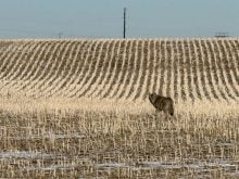
REGINA (Staff) – The string of violently destructive storms that have torn into southern Saskat-chewan in the past two weeks cannot be attributed to a single cause, says Environment Canada.
“We’re catching every atmospheric disturbance that’s rippling through,” said government weather expert Barry Johnson.
The table for storm weather was set when the jet stream moved over the province, he said. The jet stream is a flow of fast-moving air that passes between the hot and cold weather systems. Since it is an area of constant conflict between the two types of air, the jet stream often brings storms.
Read Also

Agritechnica Day 2: The future of tractor power, building quicker crop apps and large farms and tech
Agritechnica Day 2: The future of tractor power, building quicker crop apps with Syngenta and large farms and tech
Hot and humid air
Combined with this is the hot, humid conditions that prompt dangerous weather events. During the day the humid, ground level air heats and begins racing upward. The vacuum created sucks down cold wind from above.
The mixture of conditions has seen everything from the plow winds that demolished large parts of Oxbow and Pilot Butte, as well as the tornadoes that flailed the Spring Valley area.
One enormous storm roared down near the Alberta border, close to Gull Lake, and plowed its way east along the Trans-Canada highway recently.
Another tore up the Assiniboia area.
The storms have had offshoots that have shot north, some reaching beyond Saskatoon, bringing hail and hammering rain.
Thousands of crop insurance claims have been filed with the provincial agency. Payouts are expected to climb up to $20 million.