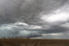
Heavy rain is forecast for southern Manitoba and southeast Saskatchewan.
Environment Canada says a low pressure system in North Dakota is tracking slowly northeastward. Significant rainfall will occur on the northwest flank of this system.
Radar indicates rain spread into extreme southeast Saskatchewan this morning.
With the slow moving nature of this system rain will be persistent today and this evening before tapering off overnight.
Rainfall amounts of 25 to 45 mm are possible over extreme southeast Saskatchewan with the highest amounts near the international border, Environment Canada says.
In Manitoba the more significant amounts will be along and south of the Trans Canada Highway corridor.
Rain will spread northward from North Dakota early this afternoon with the heaviest rainfall expected tonight.
Read Also

Canadian Grain Commission to use surplus to avoid fee increases
The Canadian Grain Commission will continue to use its surplus to cover budget shortfalls and avoid potential fee increases until 2028, the federal agency announced Monday, Oct. 27.
Rainfall amounts will be quite variable as thunderstorms are also expected with this system, especially over southeastern areas of the province.
Locations that fall under a slow moving thunderstorm will likely pick up over 50 mm of rain in a short period of time, Environment Canada says.
Heavy rain is also expected in southeastern British Columbia.