Here is Environment Canada’s past 24-hour precipitation accumulation map from Sunday morning. Southern Manitoba and southeastern Saskatchewan got the most. Also northern states. Click on thumbsize map to get full size.
Environment Canada’s warning for Manitoba
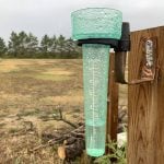
A Colorado low is spreading rain across portions of southern Manitoba. The rain is also transitioning to freezing rain or ice pellets in areas north of Brandon as cold arctic air rushes down. Melita has received the most rain so far with 83 mm. Some other rainfall amounts from areas around southern Manitoba up to 8 am are as follows: Winnipeg – 26 mm, Portage La Prairie – 15 mm, Brandon – 22 mm, Boissevain – 25 mm, Virden – 51 mm. Other parts of southern Manitoba could see total amounts in the 50 to 70 mm range by the time the rain turns to snow later today.
Northeast winds have also been strengthening throughout the morning, and are expected to peak in the 60 gusting 80 km/h range today with some areas as high as 70 gusting 90 km/h at times.
Rain has changed to snow in the Dauphin and Minnedosa regions and this transition from rain to snow will spread southeastward reaching Brandon early this afternoon, Winnipeg this evening and the Whiteshell overnight. Most of southern Manitoba will have some snow and ice pellet accumulations, with some areas possibly receiving 10 cm or more, especially from Killarney through Portage La Prairie, Gimli, and Bissett.
Conditions will begin to improve on Monday morning.


