Environment Canada’s senior climatologist is amazed by the rain in Western Canada this year.
“I think the thing that stood out was the enormous geographic extent of this excessive precipitation,” said David Phillips, one of Canada’s best known weather forecasters.
It was much wetter than normal from April to September over a large swath of land stretching from Wetaskiwin, Alta., to Whitemouth, Man.
In Rosetown, Sask., for example, 555 millimetres of rain were recorded at the Environment Canada station from April 1 to Sept. 23, which shattered the previous record set in 1954 when 464 mm fell between April 1 and Oct. 1.
Read Also
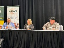
Industry shares its thoughts on agriculture policy
At last month’s Agricultural Producers Association of Saskatchewan Policy Summit, various industry heads brought forward ideas that they wanted producers to consider for the agriculture sector’s Next Policy Framework .
“It was almost 100 mm more than the previous wettest growing season,” Phillips said.
Longstanding records were also broken at many other weather stations in Saskatchewan, but there was more to the story than amounts. The frequency of rain was also unprecedented.
For instance, 100 mm of rain fell in Yorkton, Sask., in July. It wasn’t a record, but rain was recorded on 24 days, which meant there were only seven days when it didn’t rain that month in Yorkton.
“Typically it’s the other way on the Prairies,” Phillips said.
“You get a little bit of rain here and there … and you might go two weeks without another rain.”
He said at many locations on the Prairies it rained 60 percent of all the days between the end of April and the end of September.
“If it wasn’t raining, it was looking like rain,” he said.
Compounding the problem were cooler than normal temperatures over much of the Prairies that kept fields wet once they got wet.
“The growing degree days … in some places (were) lower by 20 percent or more (compared to the norm),” Phillips said.
“There was less heat for evaporating the standing water … so you couldn’t get rid of it.”
Flood forecasters in Manitoba were busy throughout the summer, issuing rare August flood warnings for the Assiniboine River Valley.
River flows have been well above normal throughout the summer and into the fall, said Phillip Mutulu, chief flood forecaster with Manitoba Water Stewardship.
For example, the Red River near Winnipeg was running at 5,000 cubic feet per second in late September, when normally it would be less than 1,000 cubic feet per second.
Phillips said this year’s higher-than-normal rainfall can be partly blamed on all the water lying on fields.
“Yesterday’s rains feed tomorrow’s rains.”
However, a more significant factor was the series of slow moving weather systems and the location of the jet stream. Rain is usually hit and miss on the Prairies, falling for a few hours before the skies clear.
However, clouds stuck around for days this summer.
“It wasn’t over in 24 hours, which you often see on the Prairie.”
Phillips wonders if historical weather is still relevant, given the drought on the western Prairies last year and now the floods of 2010.
“What this year tells us is, where’s the normal?”